Embedded Files
Where are Tom and Lennie Now? - Click here for our current location !
Add your comments and feedback here!
Day 21 and we traveled across two wonderful mountain passes. We also crossed the Continental Divide twice during the ride today.
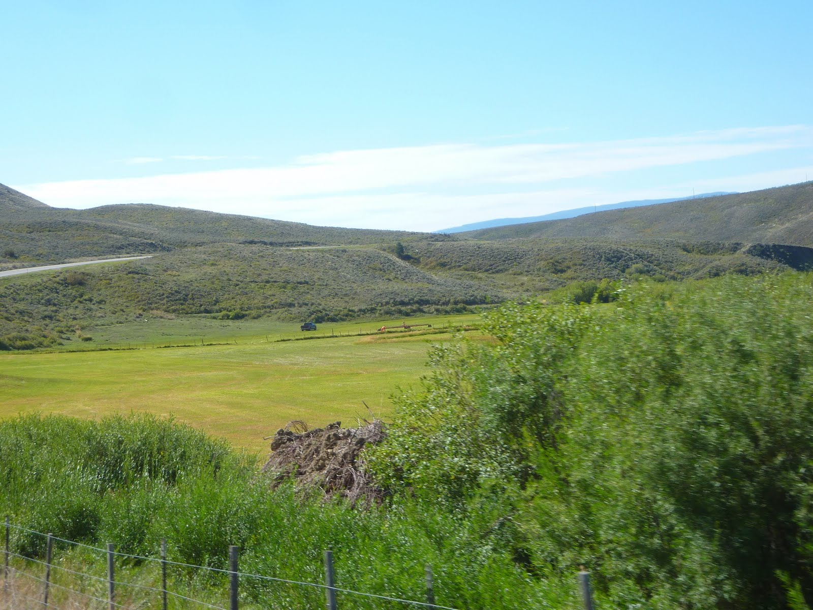
The first mountain pass was just outside of Steamboat Springs, and is known as Rabbit Ears Pass. If you look at the very top of the photo below (click to enlarge if needed), you will see a stone outcropping that looks just like a pair of (you guessed it) rabbit ears.

Rabbit Ears Pass peaks at about 9500 feet. The climb and descent are interesting, in that they are not made up of a bunch of switchback turns, but instead a bunch of large sweeping turns. You can easily maintain 50 mph while you climb from the base, to 9500 feet, and back down the other side. Another aspect that I like about Rabbit Ears, is that once up at 9500 feet, you actually stay at that altitude for a number of miles, as you pass through these huge meadow areas.
The "road to nowhere" shot for today. As you can see, traffic is light, the road is smooth, and the skies are blue. Not much more to ask for...

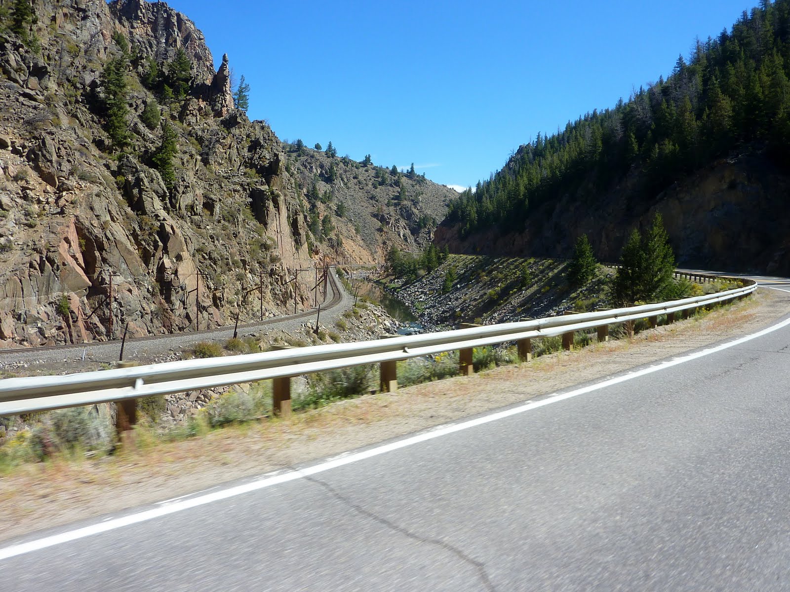
This was a neat little area. I don't remember exactly where this canyon is located, but it was somewhere between Kremmling and Granby Colorado. It was just a picturesque shot, the road bed, the river running just below the road, and the railroad tracks running just along the rocky canyon wall. It pretty much defines this area of Colorado.
Just before heading up into Rocky Mountain National Park, we passed by Lake Granby, the second largest body of water in Colorado. Another one of those bright blue mountain lakes!
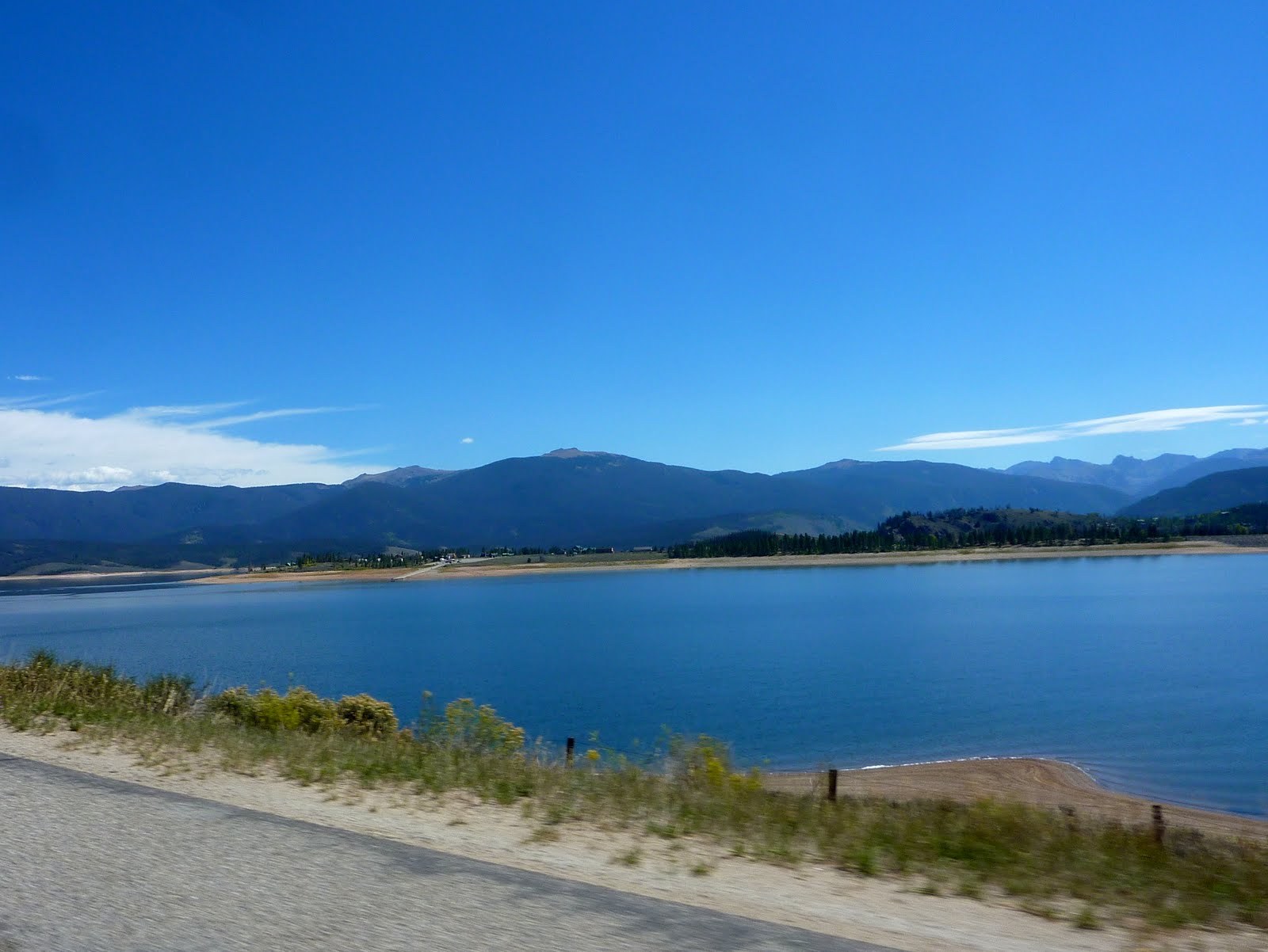
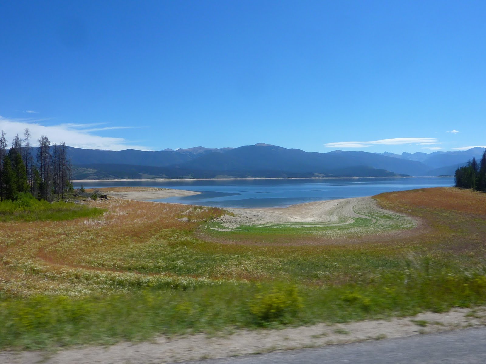
However, you can see that the lake level is low. Much like in Cleveland, the snowfall amounts for this area last year were pretty small. Little snow in the winter, means lower lake levels in the summer for these mountain lakes.

During normal times, the lake edge would run all the way up to the road berm. You can see that the water level has been low enough that tons of plant life have filled in the lake bed.
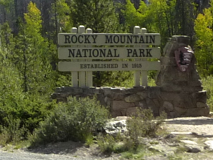
We made our way to Rocky Mountain National Park. The road through this park is called Trail Ridge Road, and climbs to an elevation of over 12,000 feet. A quick stop at the base to put on our jackets proved to be wise move (my idea of course, not Lennie's). :)
That rounded top peak toward the right of this photo is where we are heading. Temps at the base were in the upper 70's.

Most of the climb is through a forest of tall pines. The smell is wonderful, and reminds you of having a live tree in your house at Xmas time.

As we climb higher, we can start to see signs of the treeline. Note in the picture below where the trees just stop growing?

As we get above 11,000 feet, you can clearly see the change in tree growth. Those tall pines are getting pretty sparse at this altitude.

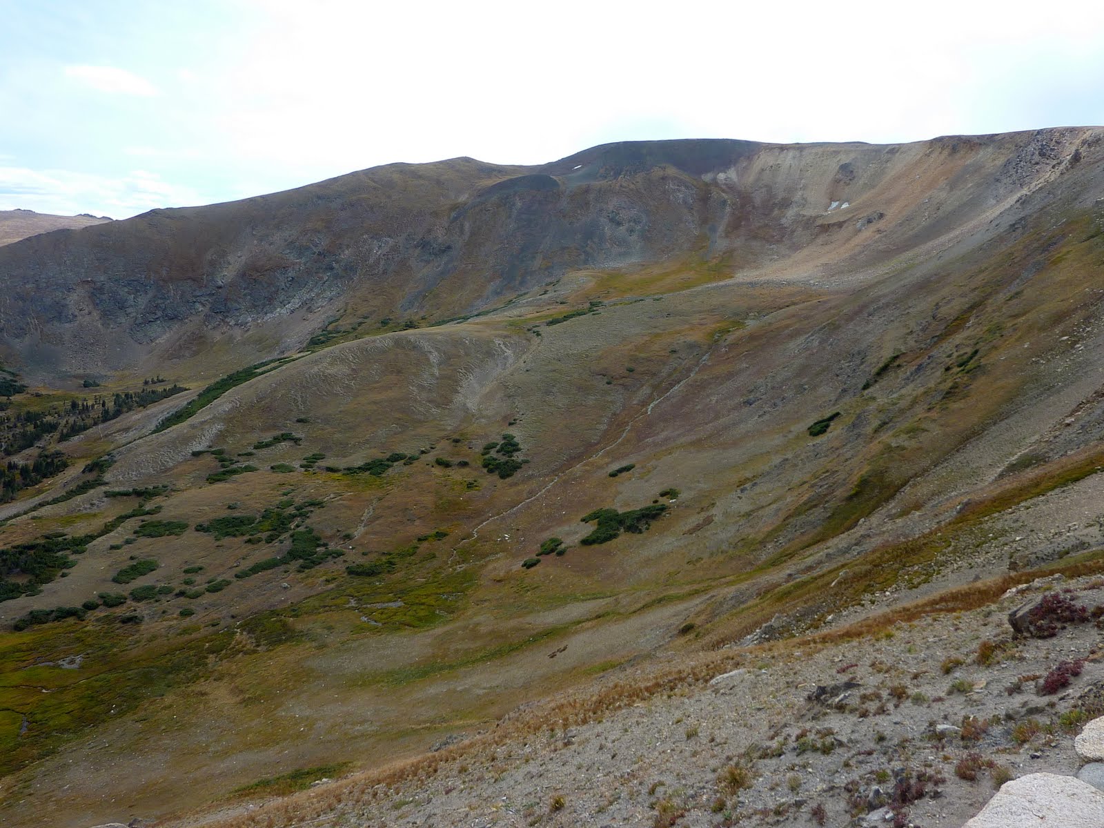
We decided to stop at the Visitor Center, which is a little bit below the road summit. From the Visitor Center, you can look out over a huge bowl area, which still had some snow beds in spots.

The colors in the bowl area were really interesting (you may have to click to enlarge to see the colors well).
There was also a gift shop next to the Visitor Center, which seemed to call out to Lennie. Perhaps it was the mountain winds calling... Lennie, Lennie, come in and spend money, we have post cards and tee shirts. I spent most of my time people watching, and talking with some other bikers who stopped into the Visitor Center.
As we pulled out of the Visitor Center, you can see we still had a bit of a climb left.

Still climbing. Love the lack of guard rails. When the winds would kick up and push the bike around, it made for some interesting moments. Fortunately, most of the stronger gusts tended to push you into the left lane rather than over the berm.

There it is, we finally crested the peak of Trail Ridge Road. Some other interesting park facts... The park contains 359 miles of trails, 150 lakes, and 450 miles of rivers/streams. The park contains over 60 named peaks higher than 12,000 feet, and over one fourth of the park resides above tree line.

Like Rabbit Ears Pass, once you are up at this altitude, the road flattens out and you stay up here for a number of miles, just buzzing along the mountain ridge. The temps up here were in the lower 50's, but the winds were pretty gusty.

As we started to descend to the east toward Estes Park, you can see we have dropped back down below the tree line. Having the trees right along the roadway created a nice wind block, and the temps started to rise again.

The east exit from Rocky Mountain National Park dumps you into the town of Estes Park Colorado. This is a quaint little town with a number of shops and restaurants. We decided to stop here and get a late lunch / early dinner at the local Mexican restaurant.
After lunch, we sat on a bench along the little creek that runs through town, and did some people watching.
Once back on the road, we made our way toward Denver. We passed through Big Thompson Canyon which runs right along the Big Thompson River. The canyon is a fun ride, with lots of tight turns and really high rock walls. You can't really see it, but just over the guard rail is the river bed.
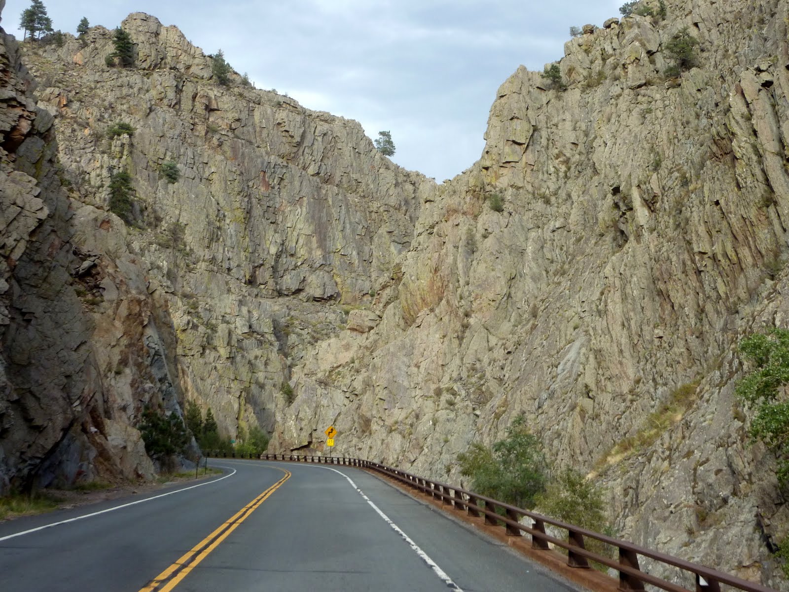
With the high rock walls, and the tight turns, you often have this feeling that you are completely boxed in while in the canyon.

Once out of the canyon, we had another 50 mile highway ride to the south toward the Denver Airport. This puts us just east of Denver and right along Route 70, which will be our launching point for the 3 day ride back home. It's hard to believe that the trip is winding to an end. :(
Today, we traveled 234 miles from Steamboat Springs CO to Denver CO. This brings the trip total to 5050 miles. Below is a map of the route from today.
Google Sites
Report abuse