Embedded Files
Where are Tom and Lennie Now? -Click Here For Our Current Location
Click here for an overview of this trip.
Add your comments and feedback here!
After spending the night in Cody Wyoming, we head out today to spend some time in the Big Horn Mountains. We will also visit the Little Bighorn Battlefield National Monument today.
We had a 70 mile run from Cody to get to the entrance of the Bighorn National Forest, and the first climb into the Bighorn range. The 70 miles was mostly sparse, with the land being almost desert like. It was very hot and pretty hazy, but you could just make out the mountain range in the distance. As we got closer to the mountains, the landscape changed drastically.
Here is a photo of the mountain range once we got close enough that the haze didn't effect the view.
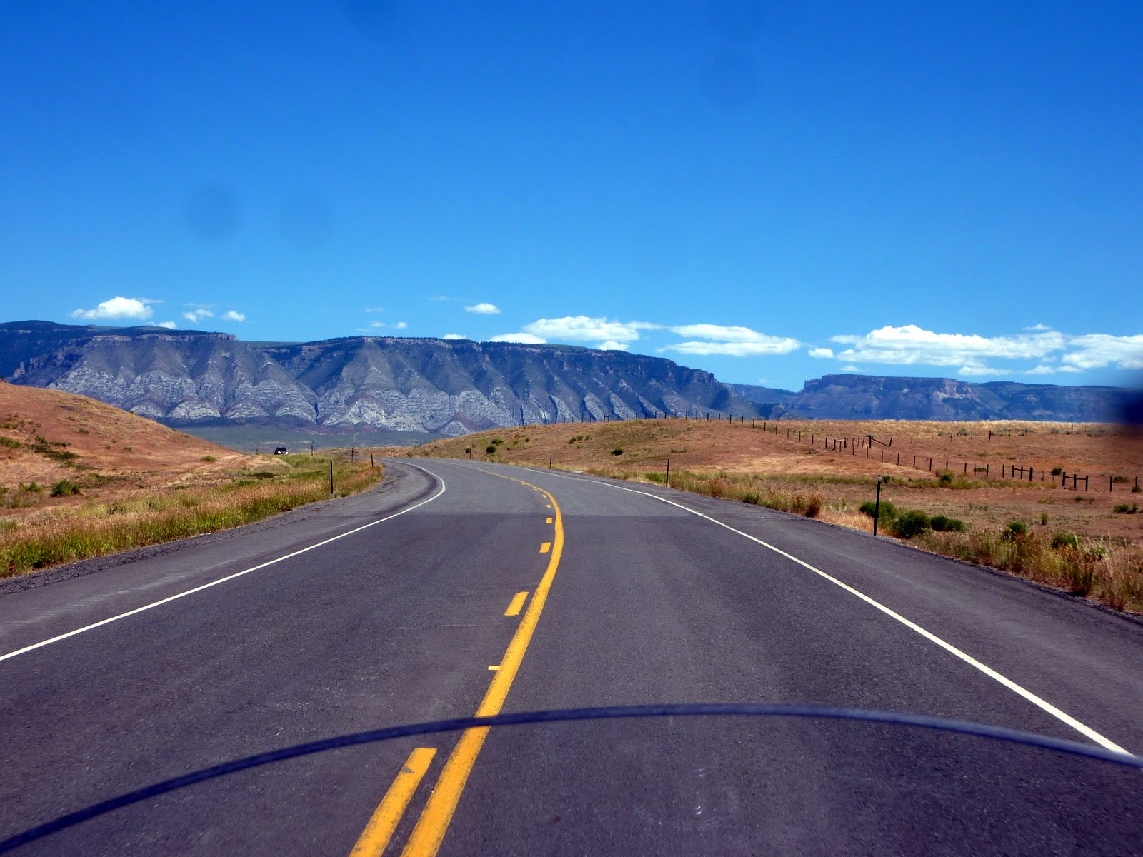
The landscape in this area started to remind me a lot of Utah. There were rock formations jutting out of the strangest places. The dirt and rock formations even had that Utah red color.

What a difference 70 miles makes, as we move from desert like to pretty rugged.
This is the entrance into the Bighorn National Forest. Looks like a fun ride ahead of us. The road will climb to just over 9000 feet. Hopefully the temperatures will cool down as we climb.

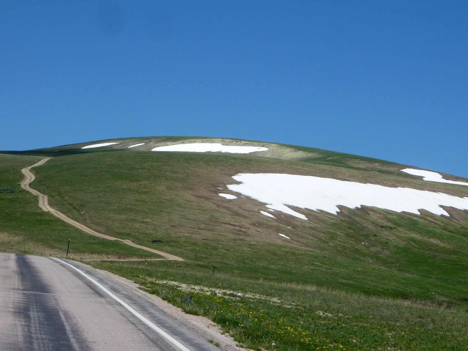
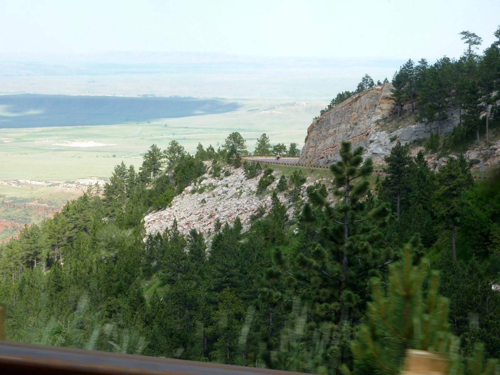
The climb is not as rugged, nor as breathtaking as Beartooth, but it is a very pretty ride. Once at the top, you have about 30 miles of plateau meadows to ride through. Pretty, but tons of deer up here, you really need to be alert.
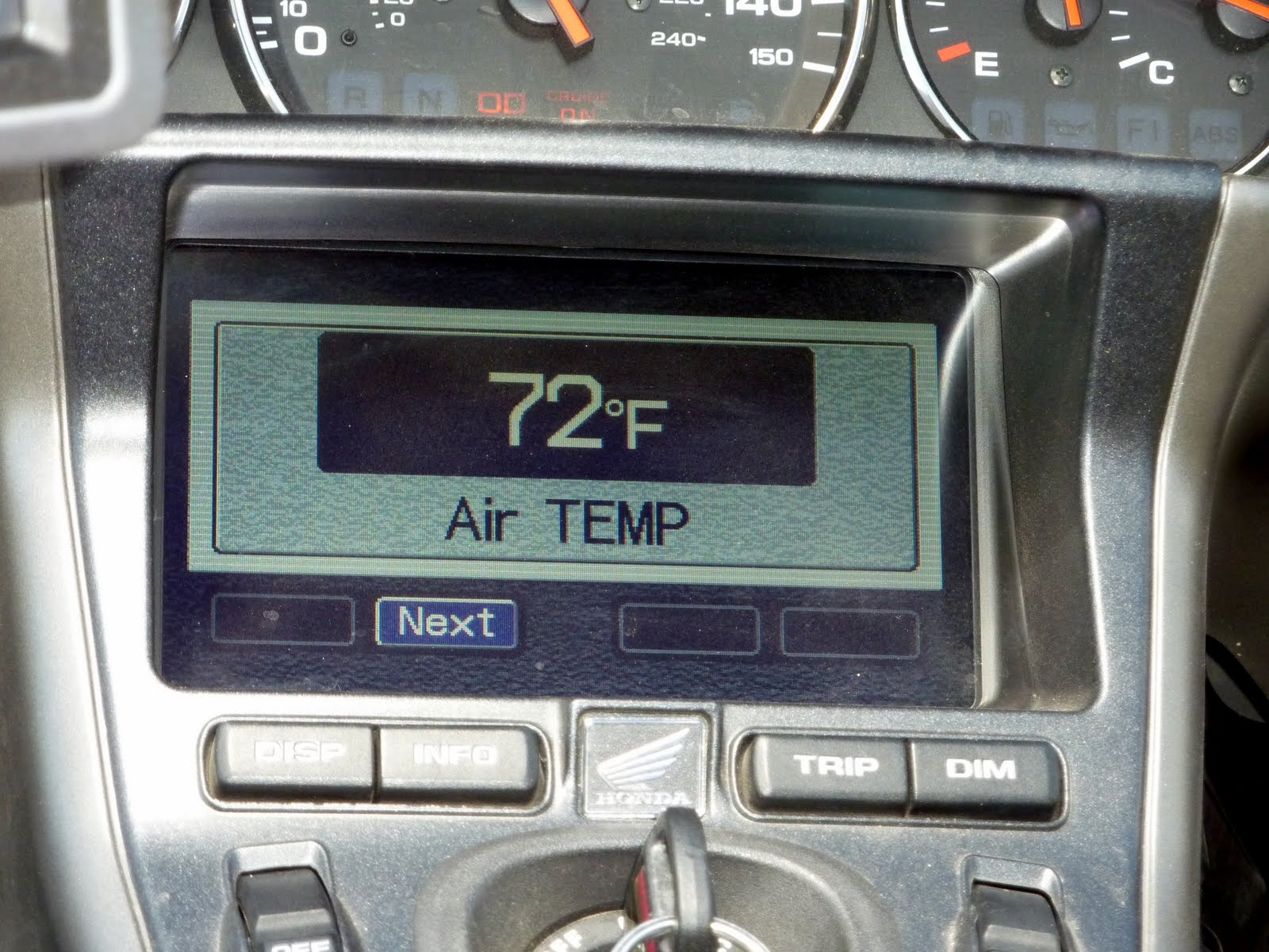
At least it was cooler. Here is a shot of the bikes air temperature readout just prior to climbing into the mountains. Yup, pretty hot out here, especially when you spend most of the day running around on the hot asphalt.

Here is a shot of the temp at the summit of the Bighorn Mountains, MUCH better.
At the top we found a little backwoods "resort". Basically a place with a bar, fuel, and a couple of pretty basic hotel rooms. Not your typical Hampton Inn mind you.
Even the gas pump makes you wonder if you should really put any of this into your tank. But, around here, you have to grab fuel where ever you can.

We top off with fuel, and take a look at a nearby road sign. We climbed to the "you are here" location by coming up Rt 14 in the lower right portion of the map. The way "out" is to the upper right, and not really shown on the map. Route 14A looks really interesting heading back down into Lovell. Who can resist "10% grades" and "sharp curves"?
We decide to take 14A, even though it is the opposite direction we need to travel. The plan will be to run down only as far as the bottom of the switchbacks, and not the full 52 miles into Lovell. Then we'll turn around and head back up, twice the ride, twice the fun.

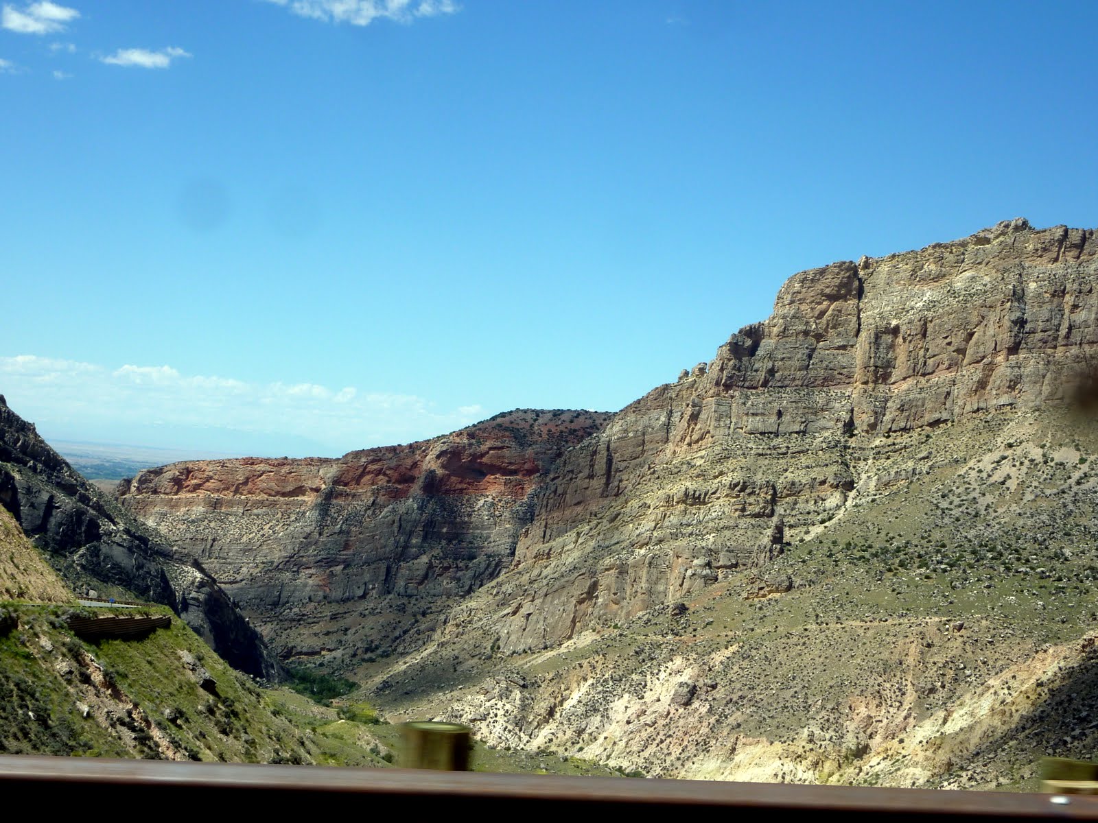
You can see the valley floor as you descend down 14A. Gotta make sure your brakes work, if you miss that turn ahead, a trip over the guardrail leads to a long way down :)
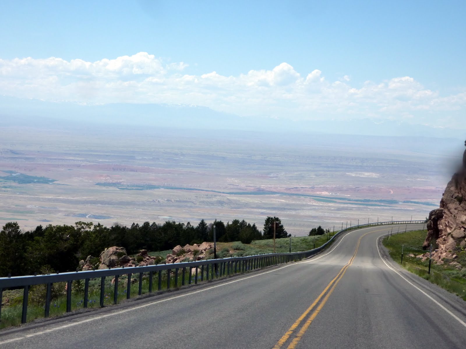
There are some pretty steep drops to get down into the valley.
From one of the pull-offs, you can see the road down in the valley. We will only ride until the grade flattens out, then turn around.

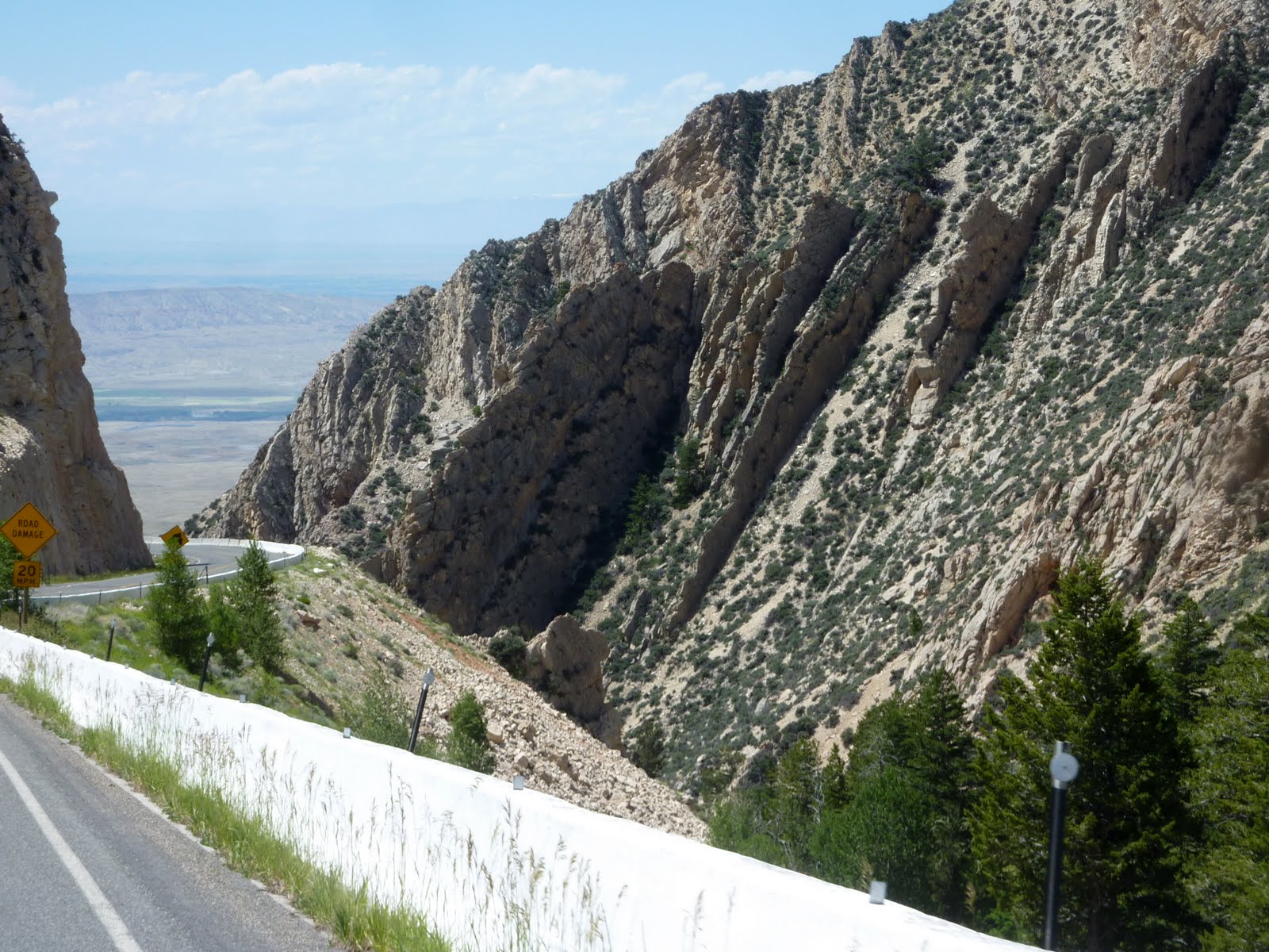
Below is a neat shot of the road across a little gorge.
We eventually reached the bottom, which is about a 35 mile drive from the big yellow sign. At this point, we turn around and head back up. The photos really flatten out the road, and you really don't appreciate how steep the climb is until you start back upward. There were a couple of sections where the wing temperature gauge started climbing because you could not keep up your speed enough to push a large volume of air through the radiators.
The very start of the climb was probably the steepest section of road that I have ever climbed with the wing. Well worth the detour!!!
Once back up top, we made a second stop at the "resort" to grab a late lunch. They were having a BBQ cookout, and you could get chicken, burgers, corn on the cob, baked beans, not bad for a hole-in-the-wall kind of place.
After lunch, we dropped back out of the Bighorns toward Sheridan WY to the east. Not as dramatic a descent as 14A, but a pretty nice drive.
One more quick fuel stop, and we were on our way to Little Bighorn Battlefield about 65 miles to the north of Sheridan.
Below is a photo of a small section of the actual battlefield.

The cemetery here reminds me a lot of Gettysburg.

The battle took place in June of 1876.
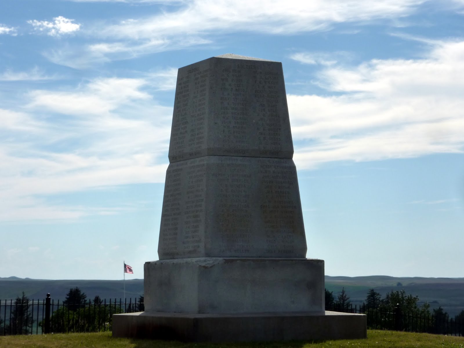
Most of the men under Custer's immediate command were buried in the field where they fell. Custer was buried here as well, but one year after the battle, his remains were moved to the West Point Cemetery.

Lieutenant Charles F. Roe and the 2nd Cavalry built this granite memorial in July 1881. It stands on the top of "Last Stand Hill", where the last few men, and Custer himself were killed. When Roe built the memorial, the 2nd Cavalry also moved all of the soldiers' remains near the new memorial, but they left stakes in the ground to mark where they had fallen. In 1890 these stakes were replaced with the marble markers you see in the photo above.
Below is a photo of the memorial built by Roe.
After the battlefield visit, we had a 65 mile run back down to Sheridan and our hotel for the night. During the last 15 miles, the skies turned black and looked pretty menacing, but we slipped into the hotel before the rain actually fell.
With the hot weather out here, we are doing some re-routing for the last week of our trip. We had planned to drop down into northern Colorado near Steamboat Springs, and pass through the Rocky Mountain National Park. However, that area is looking like it will be getting some pretty good storms over the next bunch of days. Running into storms at over 12,000 feet in Rocky Mountain National Park would be no fun, so we are heading to South Dakota instead.
We will spend the next couple of days in the Mount Rushmore area, and then start heading toward home on Wednesday. Hard to believe that the trip is coming to an end.
Our stats for today indicate that we covered 321 miles, bringing our trip total to 4864 miles. Below is a map of our route from today.
Google Sites
Report abuse