Embedded Files
Where are Tom and Lennie Now? -Click Here For Our Current Location
Click here for an overview of this trip.
Add your comments and feedback here!
For those of you who are observant, you may have noticed that my day 10 info has been late in coming. I decided to take a night off of blogging last night, and if you read on, you'll learn why.
Today started out perfect in every way. The weather was beautiful, and the planned ride was much anticipated. It was to be a "riding" day today, not a "sightseeing" day. Twisty mountain roads with little to no traffic for a 100 miles at a time, life is good. We would also get to tick off 2 additional states that we have not visited before (Washington, and Oregon). We spotted the Oregon sign, but somehow missed seeing a Washington sign. Our GPS tracks do show that we actually visited Washington :)

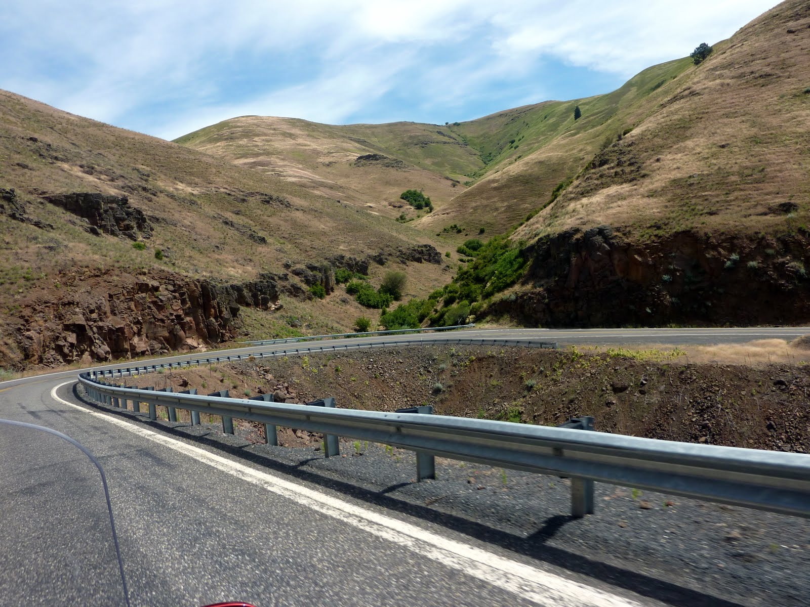
Leaving Lewiston, we crossed the Lewiston-Clarkston bridge into Washington, where we caught Route 129 toward the Oregon border. This route travels over an scenic mountain pass, with large elevation changes and multiple switchbacks. My favorite kind of road on the bike.
If you look at the photo below, you can see the road as it switches it's way down into the valley. Click the photo for a larger view.

Lot's of these in the ride today !!
I really enjoy when you can preview the road you will shortly be traveling!
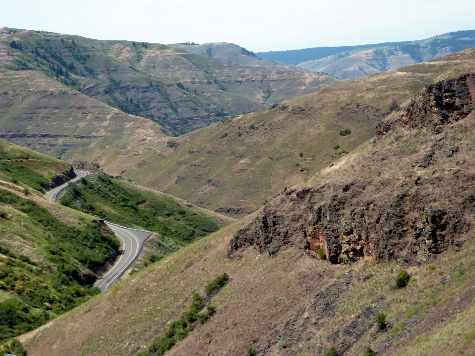
More switchbacks.

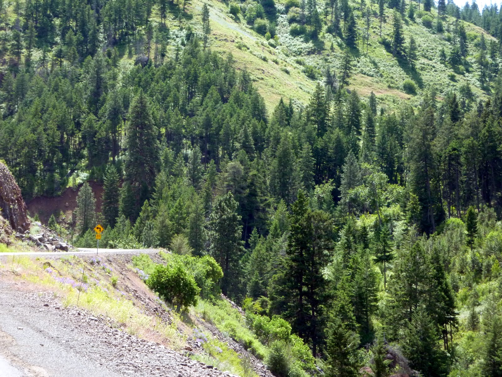
The terrain around this area is somewhat unusual, kind of a mix of rocks, some trees, and a lot of scrub grass.

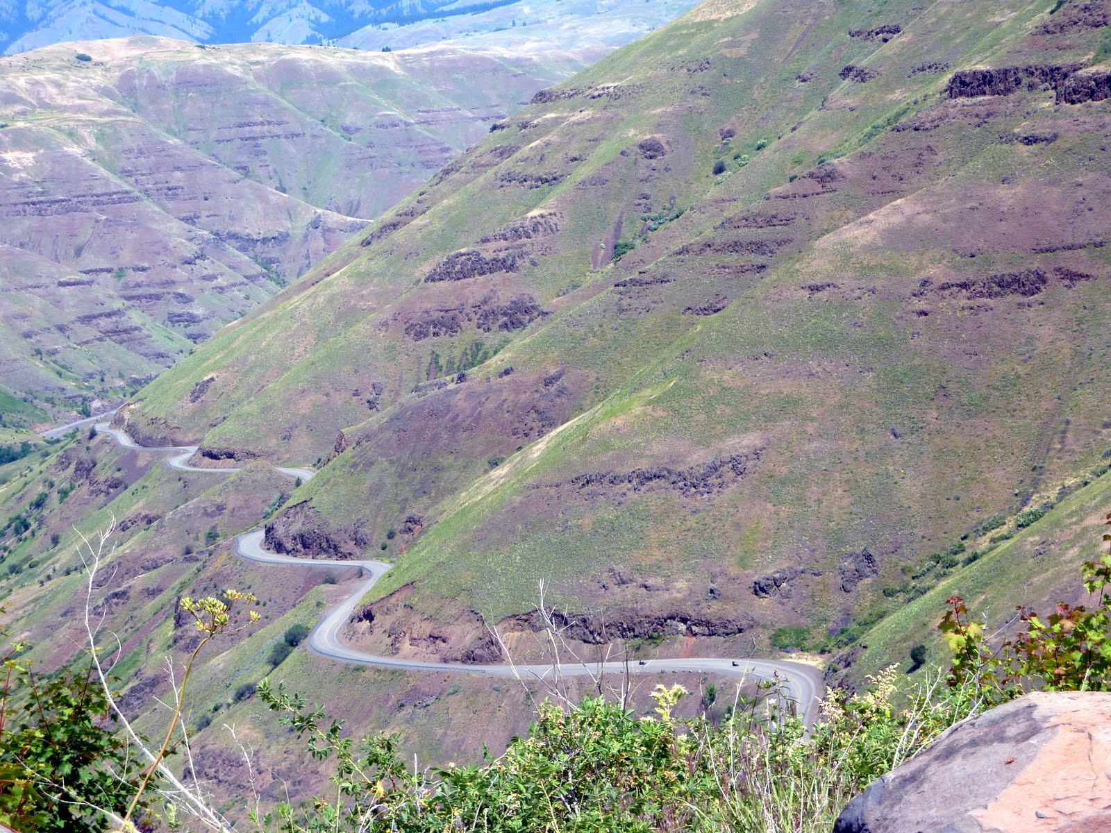
Like many of these types of roads, there are no guardrails, and the ravines are steep and deep, so concentration is important. I actually enjoy the fact that Lennie takes these photos, because on roads like this I often miss that the ride is so scenic.
Thought this was a pretty neat shot of the road running along the mountain edge, good job with the camera Len. Remember, she takes 99% of these photos from the back seat while moving.
We eventually run out of mountain road, and drop into the towns of Enterprise and Joseph Oregon. Small towns, but quaint, and they have food and gas, always important. We ate lunch, and met a nice couple from Spokane who were out for a week long ride, and were just heading back home. After lunch, we headed out to cross through the Hell's Canyon Recreation Area.

Talk about a lonely road! The photo below was basically the view we saw for the entire 75 miles. Nothing but pines right up to the sides of a somewhat narrow, paved road. We did come across a camper or two being pulled the other way, but that was about the extent of any signs of life.

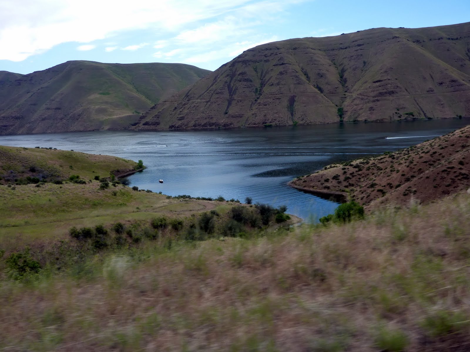
After exiting the Hell's Canyon area, we end up running along the Snake River which creates the border between Oregon and Idaho.

There were a few boaters out enjoying the day.
Some might remember, that the Snake River is one of the locations that Evel Knievel tried to jump. His jump took place much farther south down the river than where we were located. In fact, the state of Idaho would not let him use any public land for the jump site, so he purchased his own piece of land along the Snake River.
He hired a contractor to build what was basically a steam powered rocket with a seat (I would hardly call it a motorcycle), that Evel called a Sky-Cycle.
The entire event which took place in September 1974 turned into a debacle... the spectators rioted the previous night because of excessive beer and concession prices. Then, when the Sky-Cycle was eventually launched, the parachute accidentally deployed, and strong headwinds blew Knievel back into the canyon where he crashed, 600 feet below, on the SAME SIDE of the river from which he was launched (picture me laughing and shaking my head).
In addition, the restraint system in the cycle failed, and Evel was unable to get out. Luckily, he landed just a few feet from the swirling waters of the river. Finally, the twelve thousand spectators trampled the restraining fences, and each other, to try to get to the edge of the canyon and see what had happened. Miraculously, Evel walked away with only minor injuries.
After a long days ride, we finally reach our destination for the night. Bonus, it's BOTH a Hotel and a Motel all in one. Looks like they even have phone service and fuel.

Ok, so we were really heading to a Holiday Inn in McCall Idaho.
Then, 40 miles from our hotel, trouble began. Below is a shot of an evil town, a town that I hold in great disdain, Council Idaho !!! We travel down main street, and take a right at the only intersection in town. Then we hear a horrible sound, thump-thump-thump, even Lennie knew what it meant. A flat tire??
I hoped it was just a rock stuck in the tire tread. However, after pulling over to the side of the road, a quick look showed a large nail sticking out of the tread. This would be our first tire failure on a long trip, talk about disheartening.

Lennie enjoyed taking a few shots of me with my patch tools laying along the road. One thing I learned, is that everything under there is extremely HOT after a long days ride. Even the aluminum tire rim was hot.
I carry two sizes of tire plugs, large and small. And of course the hole was too large for a small plug, and too small for a large plug. So, I inserted two small plugs and pumped up the tire with a small 12 volt air compressor we carry on the bike.
We pick up the tools and head off, with 40 miles to go. My tire pressure monitor shows that the tire is losing air as we travel. We get about 20 miles and have to pull over again. I shove two more small plugs into the hole, air up the tire again, and we head off.
We make it the additional 20 miles and arrive at our hotel around 8 PM. The tire is still leaking slowly. Of course, everything is closed on a Sunday night.

Here's the culprit, thanks Council Idaho !!!

Looks like tomorrow will leave us hunting for a tire or motorcycle shop, in hopes for a repair or new tire.
A great ride today, with a disappointing ending.
Our stats for today indicate that we covered 272 miles, bringing our trip total to 3376 miles. Below is a map of our route from today.
Google Sites
Report abuse