Embedded Files
Where are Tom and Lennie Now? - Click here for our current location !
Add your comments and feedback here!
Day 10, and the plan is to visit Yosemite National Park. Lennie is anticipating an exciting hike as well. More on that later.
After 24 days where the average high has been 104 degrees, the Merced area is finally going to have a day with "normal" temperatures. The forecast says the high for the day is only going to be 90 degrees :)
We have a two hour ride from our hotel to the park, so we pack a cooler of drinks and head off toward Yosemite.
We passed by another orchard on the way, this time they are growing pistachios. If you look close, you can see clumps of them in the tree branches.

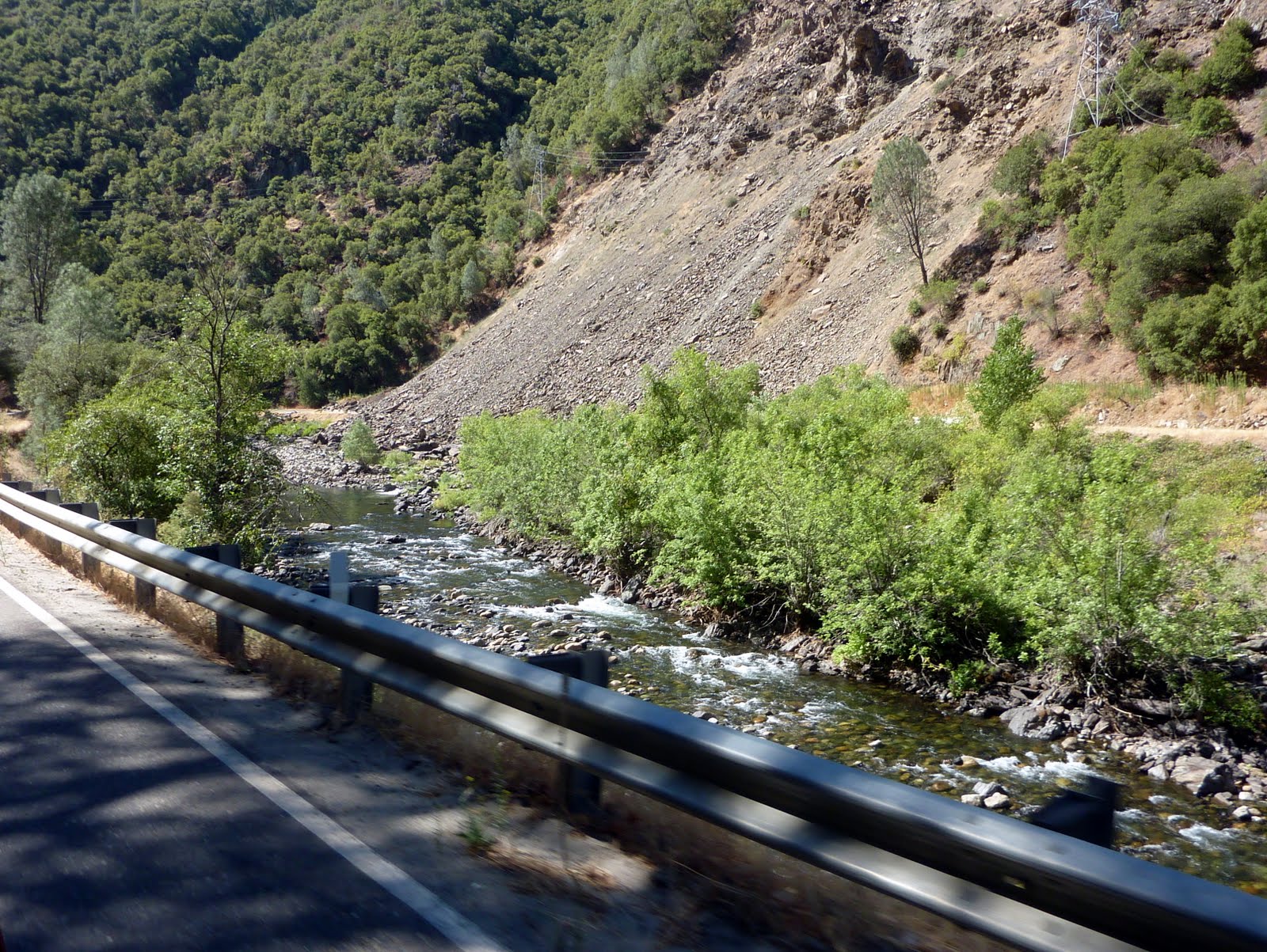
After a 90 minute drive, we finally enter the Yosemite Valley. The roadway follows the Merced River through most of the valley, and the entire area is very scenic. We climb from the valley floor of about 500 feet above sea level, to the park, which sits at about 4000 feet above see level.

Oh no, what's this....

Like the sign indicated, we waited for roughly fifteen minutes, then the light turned green. We crossed this single lane bridge, and traveled down a 1 mile section of single lane road.
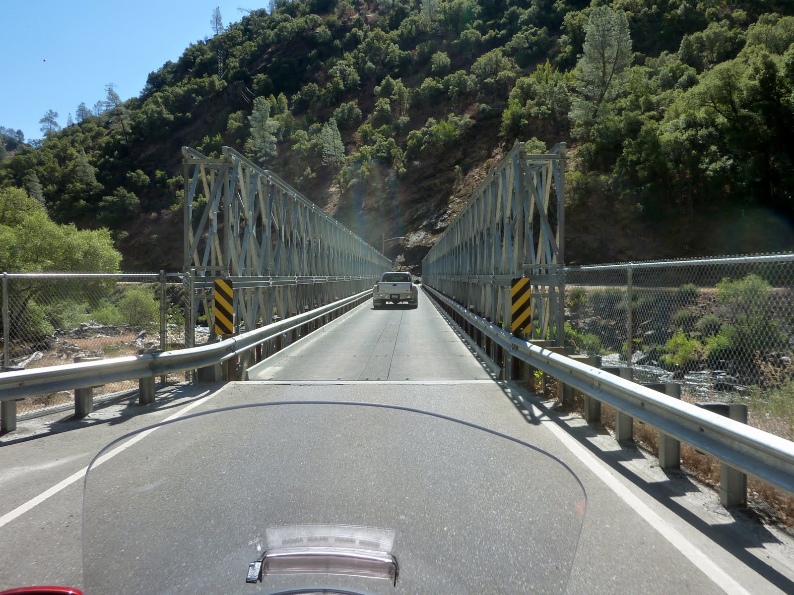
Ah, there's the answer. The main road is no longer passable. You can see what is left of the old main roadbed across the river, and how a huge section of it is covered from a massive rock slide. The one lane section is a new temporary answer, and traffic is controlled with the traffic lights. I found this statement on the National Park web site....
"There is currently no estimate for the reopening of the road. The geologists, along with engineers, are looking at possible solutions that would replace the current road. The slide continues to be active and has so far deposited about 300 million cubic yards of shale onto the roadway and into the Merced River."
Once we entered the actual park, we drove through and under a number of interesting rocks...
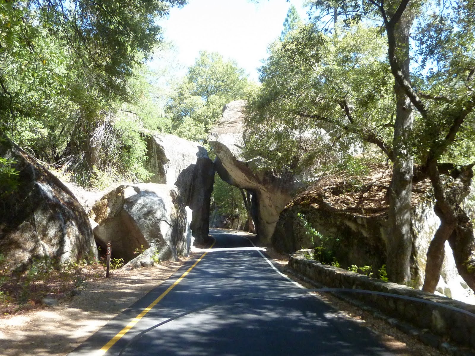
Remember the previous rock slide? Hope this one stays put for a while.

This one too...

Most National Parks are known for one certain thing, a type of terrain, an iconic mountain, a certain species of animal, etc. The unique thing about Yosemite is that it contains so many types of interesting sights. You will find (not surprisingly after yesterday) Giant Sequoia trees...

Water, water, everywhere, with tons of waterfalls and streams running through the park. It is august, so the water is not as plentiful as in the spring.

And every nook and cranny where you can see through the trees, you see rock formations. Many of the rock formations are iconic, and easily recognized.
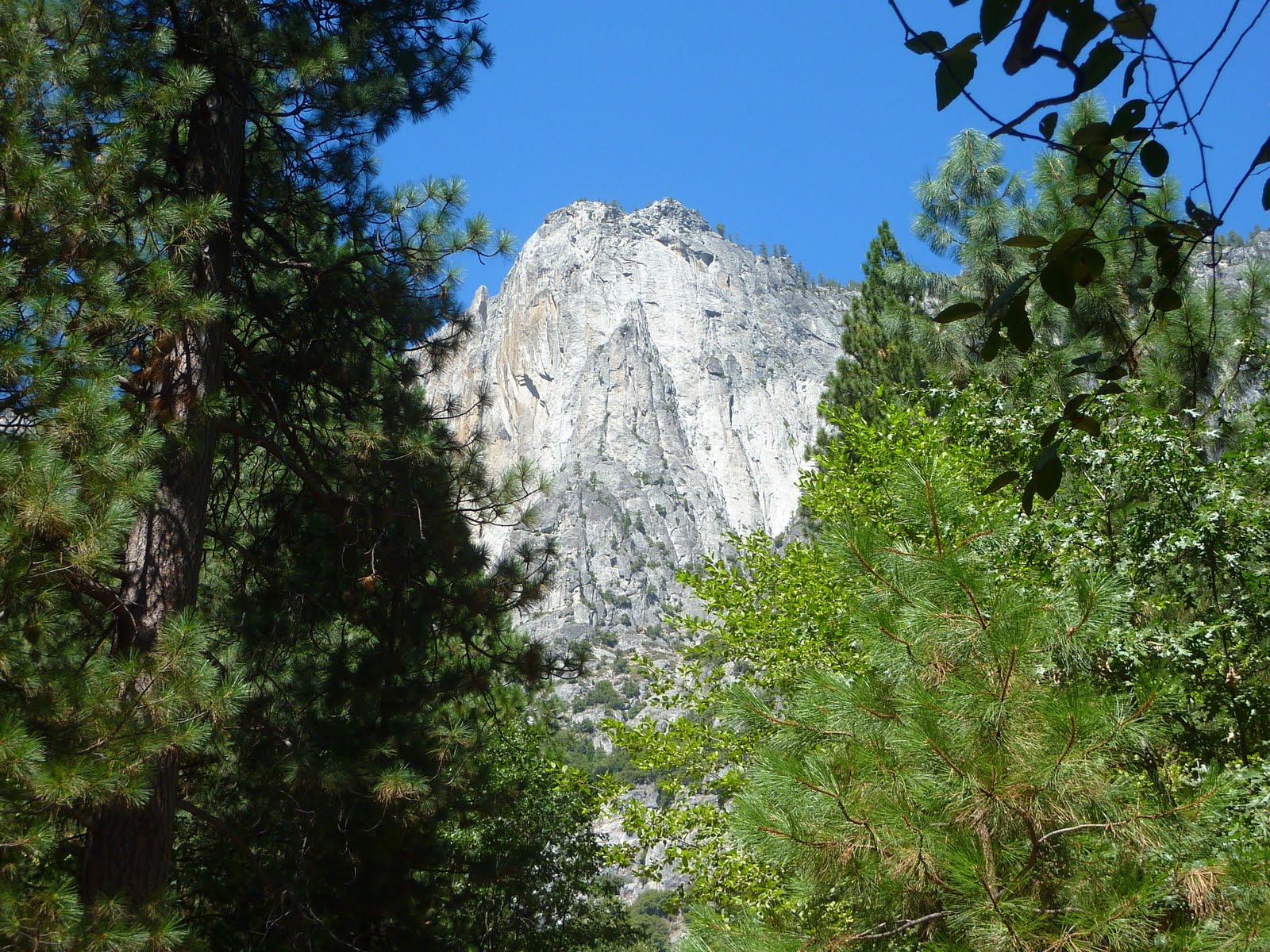
The rock formations in the park are massive, making Yosemite a climbers heaven.

We passed the first iconic rock formation in the park, El Capitan. The granite monolith extends about 3,000 feet from base to summit along its tallest face, and is one of the world's favorite challenges for rock climbers.

Once considered impossible to climb, El Capitan is now the standard for big-wall climbing. "El Cap" has two main faces, the Southwest and the Southeast. Between the two faces juts a massive ridge/prow. While today there are numerous established routes on both faces, the most popular and historically famous route is The Nose, which follows the massive prow.
El Capitan also has a controversial history regarding BASE jumping, and the National Park Service has effectively banned the practice. Michael Pelkey and Brian Schubert made the first BASE jump from El Capitan on July 24, 1966. Both men sustained broken bones from the jump. During the 1970s and with better equipment and training, many BASE jumpers made successful and safe jumps from El Capitan. In 1980 the National Park Service experimented with issuing BASE-jumping permits. These legal jumps resulted in no major injuries or fatalities. However, some jumpers exhibited significant disregard for the park's rules and the environment. After a trial lasting only 10 weeks, the National Park Service ceased issuing permits and effectively shut down all BASE jumping on El Capitan. On October 23, 1999, BASE jumper and stuntwoman Jan Davis died while making an illegal protest jump in support of lifting the park's ban (so much for proving to the park system that they should allow the sport). BASE jumpers continue to fight the National Park Service in court for access to El Capitan.

Did I mention water earlier? Here is a photo of another Yosemite icon, Yosemite Falls. See the water? No? Well, that's because it's August.
Yosemite Falls is a major attraction in the park, especially in late spring when the water flow is at its peak. Yosemite Falls is the highest measured waterfall in North America, and with a total of 2,425 feet from the top of the upper falls to the base of the lower falls it is the sixth highest waterfall in the world.

If you zoom in, you can see the stains on the rock face where the water normally travels.

Here is a shot I found on the internet which was taken in the spring time as the snow melt runs over Yosemite Falls.

Another one of my dry photos from today....

Another internet, "spring" photo... You get the idea...

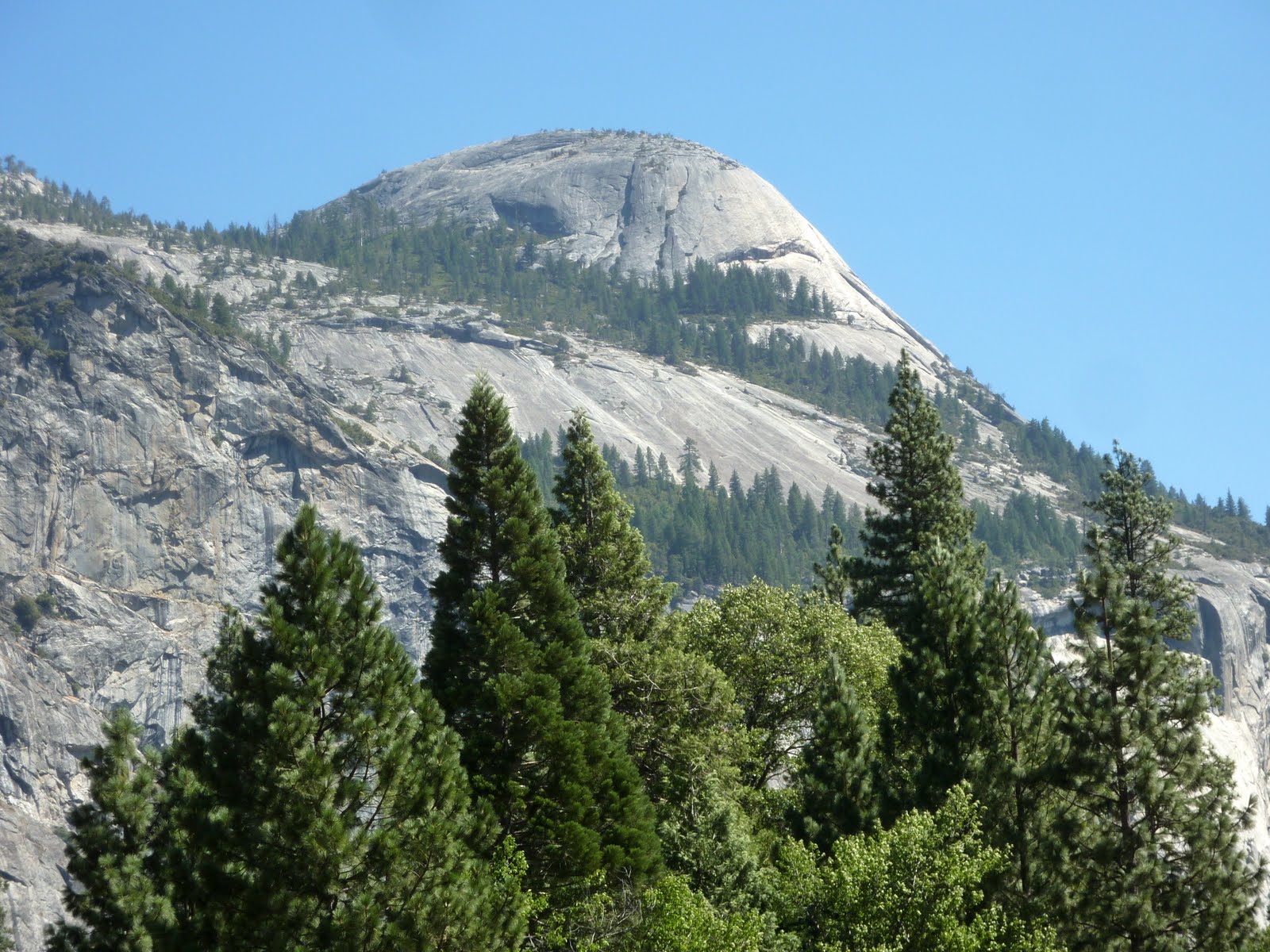
Then there is the third icon of Yosemite, Half Dome.
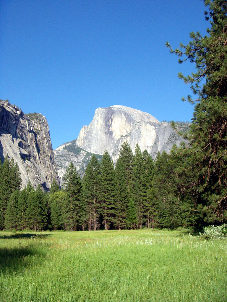
Half Dome is a granite dome, located at the eastern end of Yosemite. It is considered Yosemite's most familiar rock formation. The granite crest rises more than 4,737 ft above the park floor, giving it a peak of roughly 8800 feet above sea level.
As late as the 1870s, Half Dome was declared "inaccessible". The summit was finally conquered by George G. Anderson in October 1875, via a route constructed by drilling and placing iron eyebolts into the smooth granite.
Today, Half Dome may now be ascended in several different ways. Thousands of hikers reach the top each year by following an 17 mi round trip trail from the valley floor. After a rigorous 2 mi approach including several hundred feet of granite stairs, the final pitch up the peak's steep but somewhat rounded east face is ascended with the aid of a pair of post-mounted braided steel cables ("The Cables") originally constructed close to the Anderson route in 1919.
The Half Dome Cables Route hike runs from the valley floor to the top of the dome with 4,800 ft of elevation gain. The length and difficulty of the trail used to keep it less crowded than other park trails, but in recent years the trail traffic has grown to as many as 800 people a day. The hike can be done from the valley floor in a single long day (12-14 hours), but many people break it up by camping overnight in Little Yosemite Valley. The trail climbs past Vernal and Nevada Falls, then continues into Little Yosemite Valley, then north to the base of the northeast ridge of Half Dome itself.
Due to the ever increasing crowds attempting to hike the cable route, in December 2010, NPS officials announced that a permit system would be used seven days per week beginning with the 2011 ascent season. All hikers who intend to ascend the cable route must now obtain permits before entering the park. Permits will be checked by a ranger on the trail, and no hikers without permits are allowed to hike beyond the base of the sub-dome or to the bottom of the cables. Hikers caught bypassing the rangers to visit either the sub-dome or main dome without a permit face fines of up to $5000 and/or 6 months in jail.
The top of Half Dome is a large, flat area where climbers can relax and enjoy their accomplishment. The summit offers views of the surrounding areas, including Little Yosemite Valley and the Valley Floor. A notable location to one side of Half Dome is the Diving Board. The Diving Board is a prominent rock on the west side of Half Dome that projects out in front of the face of Half Dome. It cantilevers out about 30 feet over a shear cliff that is a 1400 foot vertical drop.
From 1919 when the cables were erected through 2011, there have been six fatal falls from the cables. The latest fatality occurred on July 31, 2011.
Lightning strikes can be a risk while on or near the summit. On July 27, 1985, a group of five hikers were struck by lightning, resulting in two fatalities.
Here is a short 10 minute video from the park service regarding hiking Half Dome. It is pretty interesting.
As I mentioned at the start of today's blog, Half Dome is the hike that Lennie has been looking forward to the entire summer! So, got on the road early this morning, and stopped outside the park entrance at the ranger station to acquire our permits. The park allows 300 day hikers, and 100 over night hikers up Half Dome each day. Believe it or not, there was only 1 day hiker pass left by the time we hit the ranger station. So, once we get to the sub-Dome area, Lennie will have to hike up the cables by herself.
Remember, this is a 12-14 hour hike and you need to ascend about 4000 feet before you even get to the sub-Dome and the cables. So we made sure to get an early start.
After roughly 5 hours of rigorous hiking and climbing, we reach the sub-dome. I was able to get a couple photos of the cables. From this point, I am not allowed to continue on, so Lennie will be on her own. You can see from the photo below, the cables section looks pretty easy :)
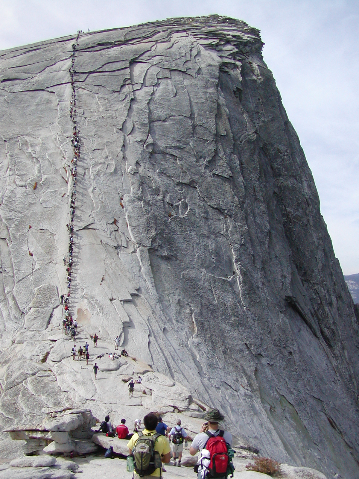
When zoomed out, you get a better feel for how long and steep the cable section is...

If you look really close, I think Lennie is about 15-20 people down from the top. Good thing there is no rain in the forecast, that rock gets really slippery when wet.

Once on top, you can stand on the famous diving board rock. Lennie said she wanted to walk out there, but these guys kept hogging the area.

After another 5 hours of hiking back down from Half Dome, we were both pretty tired. So we spent a few hours riding the shuttle around the park and taking in some of the remaining sites.
Late in the day, we headed back down into the Central Valley and on to Merced for one more night.

Tomorrow we will head back south to San Luis Obispo, which will set us up for riding the Pacific Coast Highway (Hwy 1), on Tuesday. The high in San Luis Obispo will be 81 tomorrow. The coastal temps for next bunch of days will yield highs in the mid 60's, so it will be a welcome change. We will have to trade in our cooling vests for some long pants and perhaps a jacket.
Today, we traveled 174 miles while visiting Yosemite National Park. This brings the trip total to 2976 miles. Below is a map of the route from today. This does not include the miles covered on foot :)
Google Sites
Report abuse