Embedded Files
Where are Tom and Lennie Now? -Click Here For Our Current Location
Today we headed out of Cedar City, toward Bryce National Park.
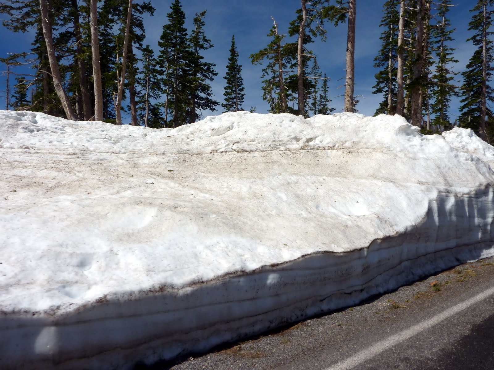
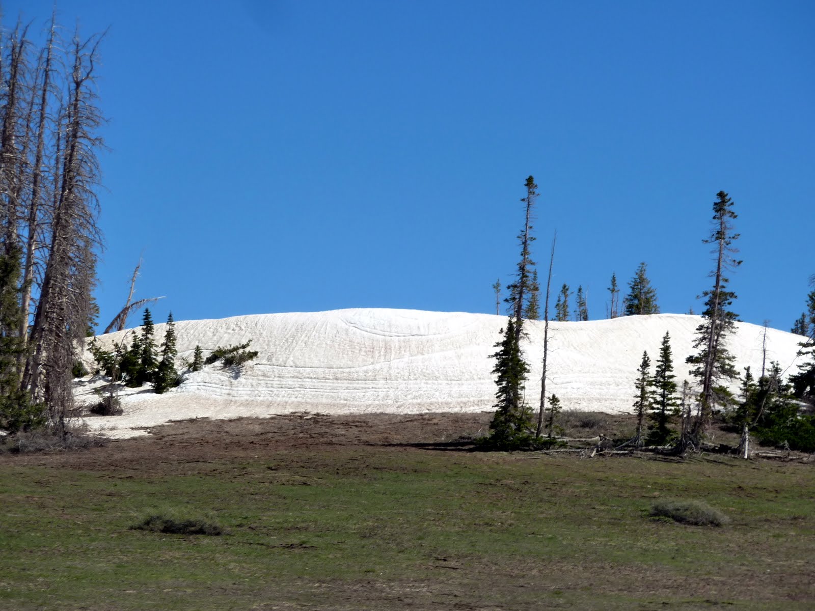
We left Cedar City with temperatures in the low 70's, yeah!!!!! The first portion of our ride took us through the Cedar Breaks National Monument. Cedar Breaks took us up to an altitude of almost 10,000 feet. The road through Cedar Breaks was just opened for the season this past Saturday. As you can see below, there is still a fair amount of snow up at this altitude.
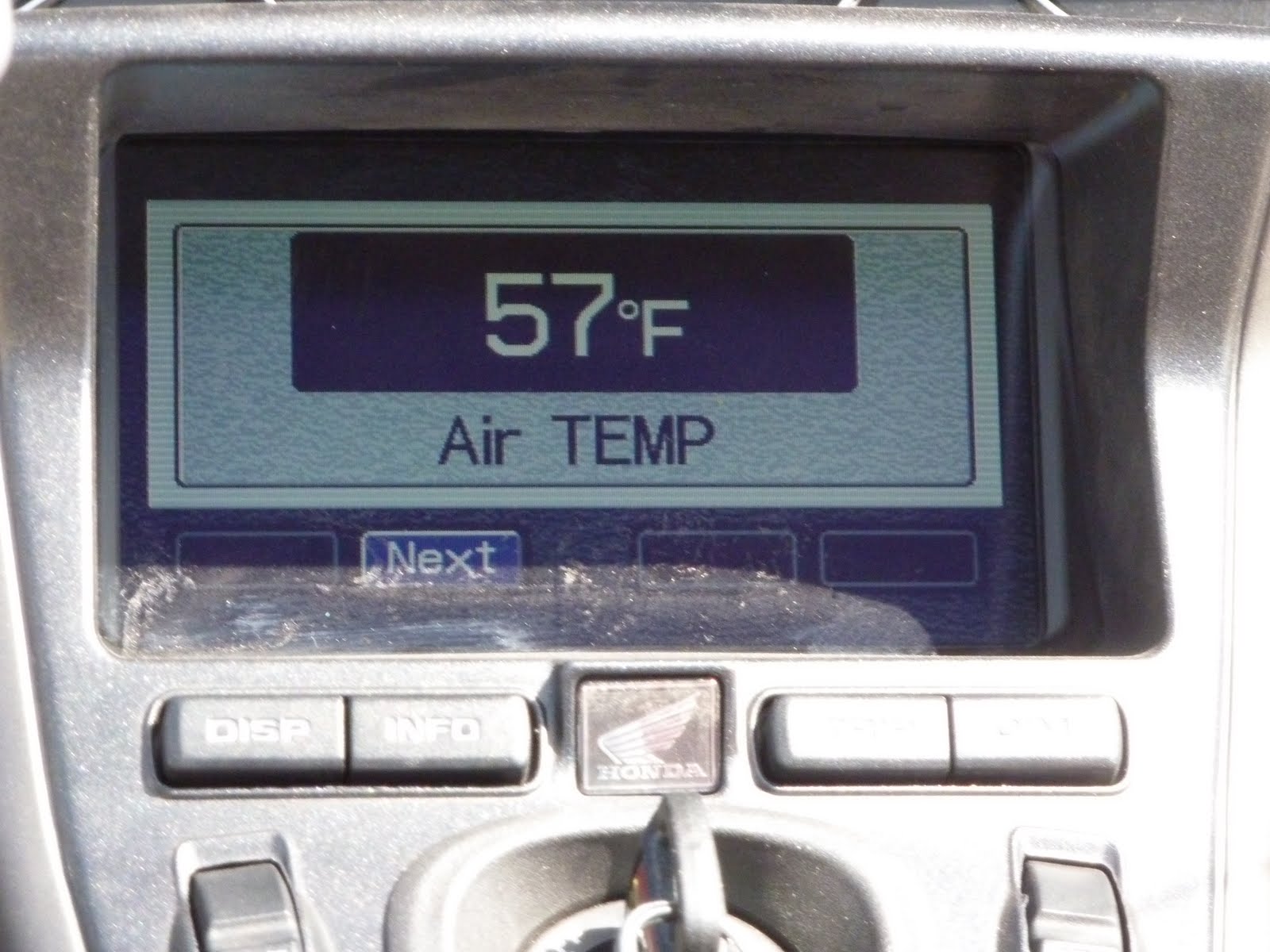
Near the top of Cedar Breaks the temperature reading on the bike showed 57 !!! It felt GREAT !!
After Cedar Breaks, we passed by Panguitch Lake, and then stopped in the town of Panguitch for lunch.
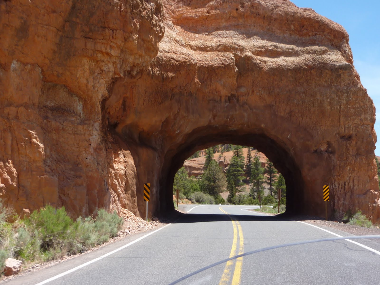
From Panguitch, our route took us through the Red Canyon area. There was a large area of red sandstone cliffs, along with a couple of interesting arches over the roadway.
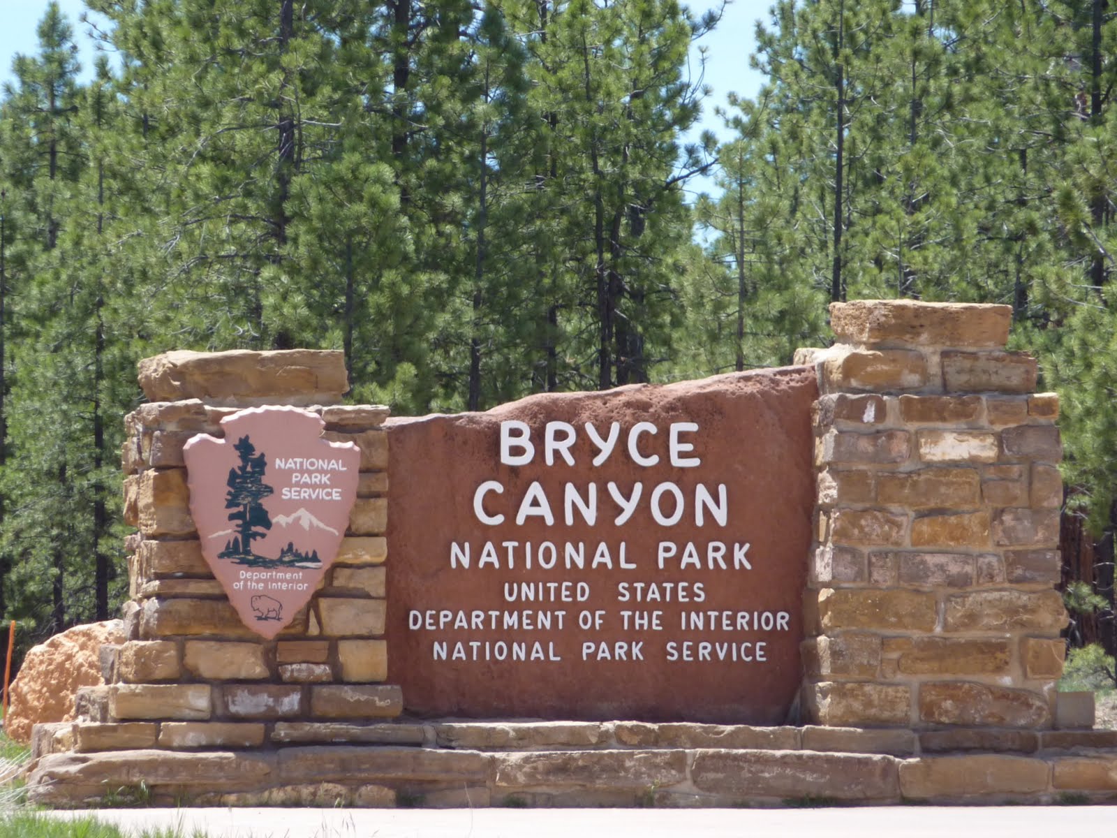
Finally, we reached the Bryce Canyon National Park. This will be the 4th National Park we have visited so far on this trip.
Bryce is famous for its huge amphitheater areas filled with giant hoodoos (spires). A hoodoo (also called a tent rock, fairy chimney, or earth pyramid) is a tall, thin spire or fin of rock that protrudes from the bottom of an arid drainage basin. Hoodoos consist of soft sedimentary rock topped by harder, less easily-eroded stone that protects each column from the elements. Nowhere in the world are hoodoos more abundant than in Bryce Canyon National Park.
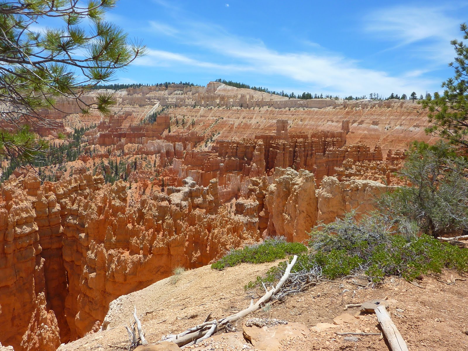
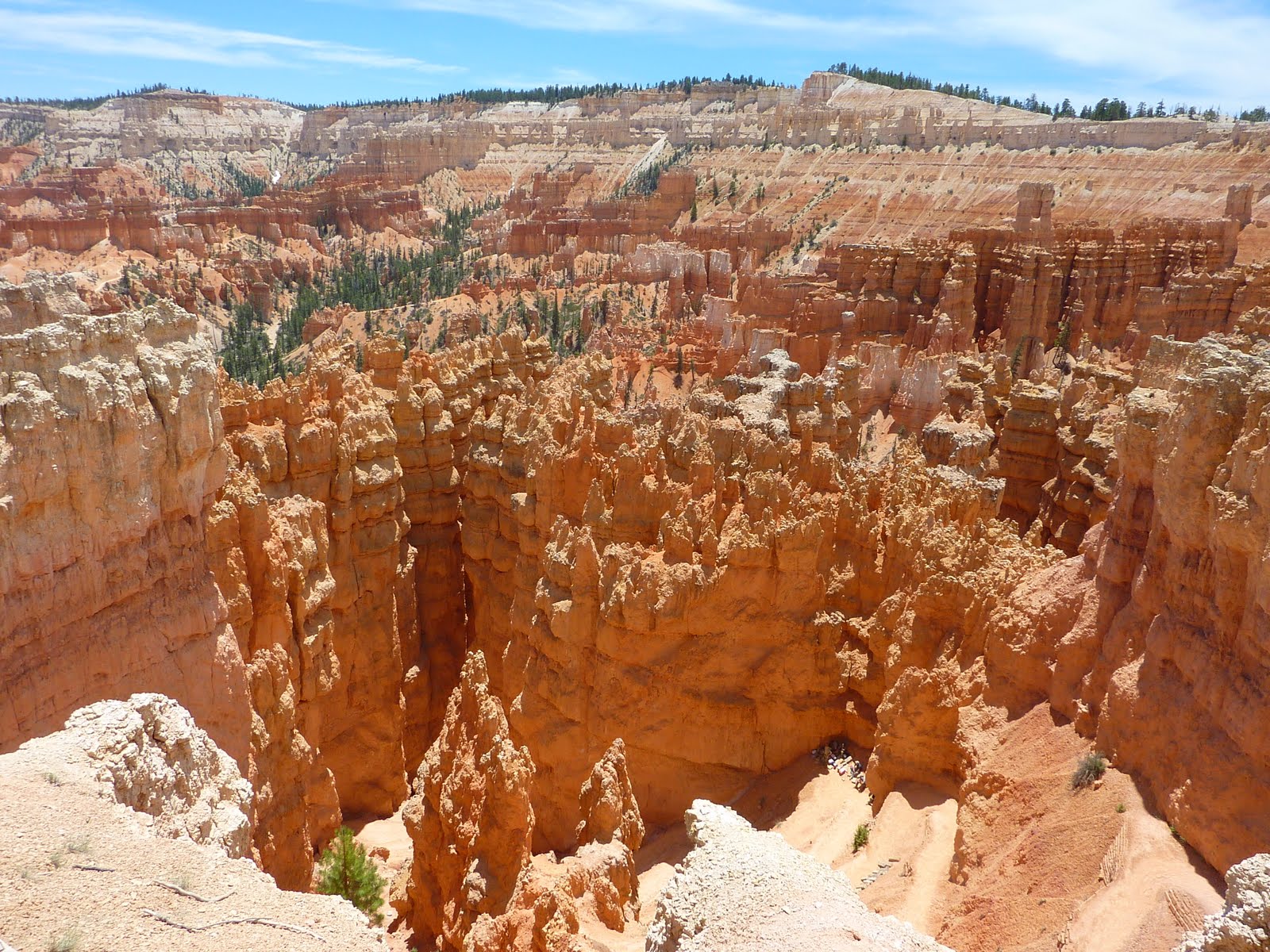
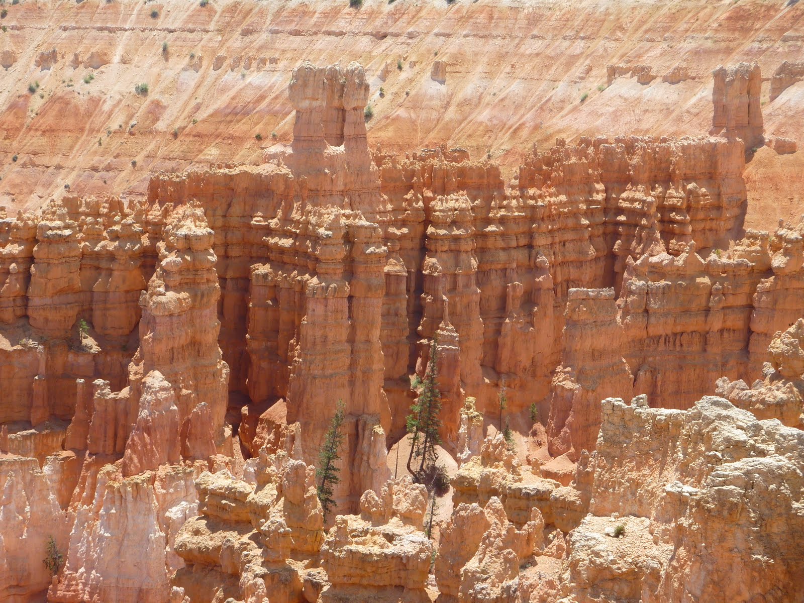

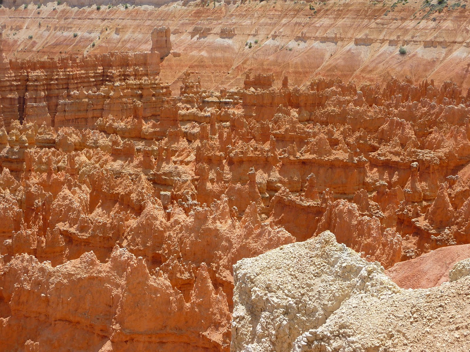
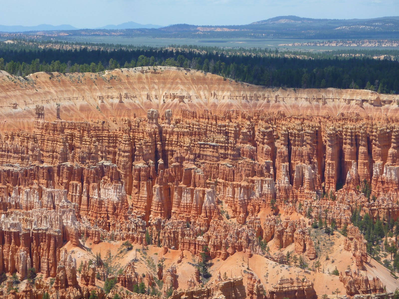
The colors in the hoodoos are incredible. There are also a large number of hiking trails down in the amphitheaters working their way between the spires and fins of rock.
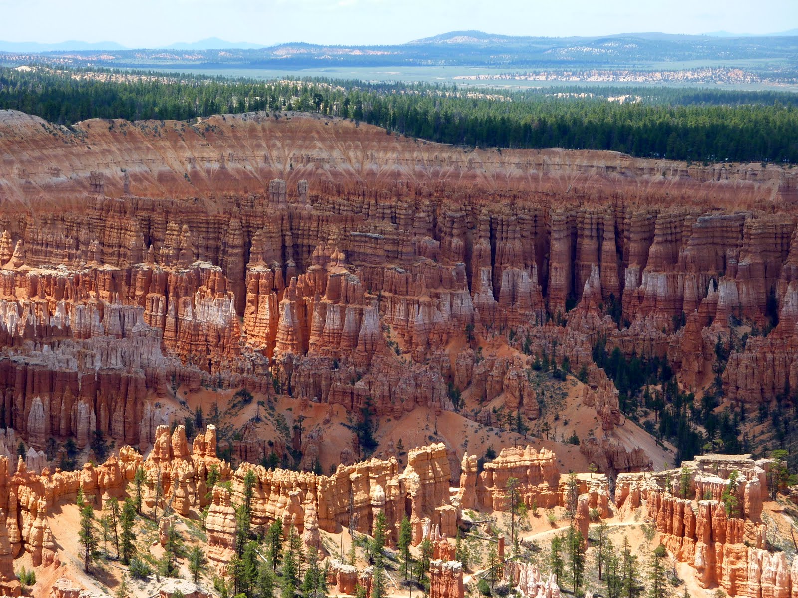
When you zoom the camera out, you get a feel for the huge size of the amphitheaters. Below is just one of the amphitheater areas. These amphitheaters extend for more than 20 miles, with the largest (the Bryce Amphitheater) measuring about 12 miles across.

Bryce is at a higher elevation than Zion, with a rim that ranges from 8000-9000 feet.
You can imagine this entire area of northern Arizona, and southern Utah as a huge staircase. The very top of the Grand Canyon is roughly at the level of the bottom of Zion, while the very top of Zion is roughly at the level of the bottom of Bryce. All 3 parks offer very different geology, and all are worth a visit.
Below is a map of our route from today. We covered about 90 miles to get to Bryce, then another 40 within the park. This brings our trip total to 3554 miles.
Tomorrow we are heading to the Grand Staircase Escalante National Monument, and the Capitol Reef National Park. We will end up spending the night in Torrey, Utah.
Google Sites
Report abuse