July 4 Day 4
Where are Tom and Lennie Now? -Click Here For Our Current Location
Click here for an overview of this trip.
Add your comments and feedback here!
First off, happy 4th of July to everyone !!!!
Looks like another hot and humid day in store for us. With the morning ritual of loading the bike and trailer completed, I took a quick look and noticed the trailer tires were wearing pretty even at this point. Looks like the increase in air pressure is helping.
Today's ride will take us the remainder of the way across North Dakota, and across a large portion of Montana. We have about 450 miles to cover, with 350 of those miles on back roads. More on those back roads in a minute...
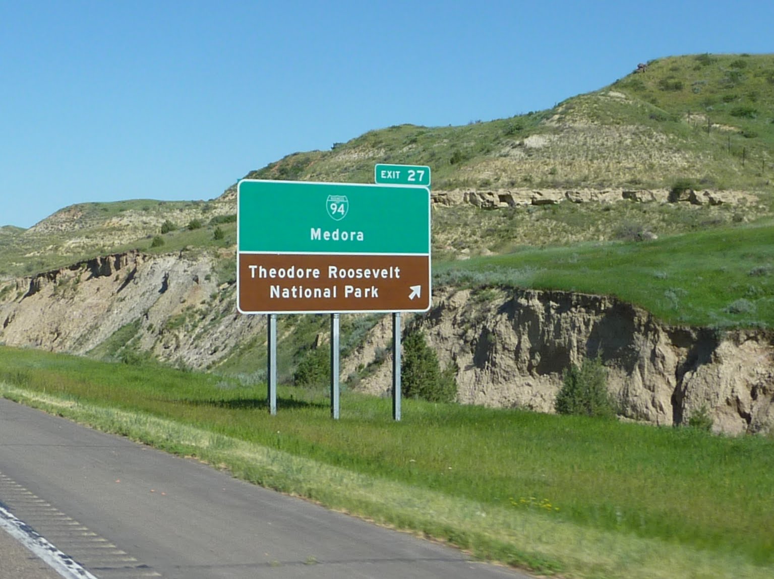
Not too far to the west of our hotel, along route 94, we come to our first National Park of the trip, Theodore Roosevelt NP.
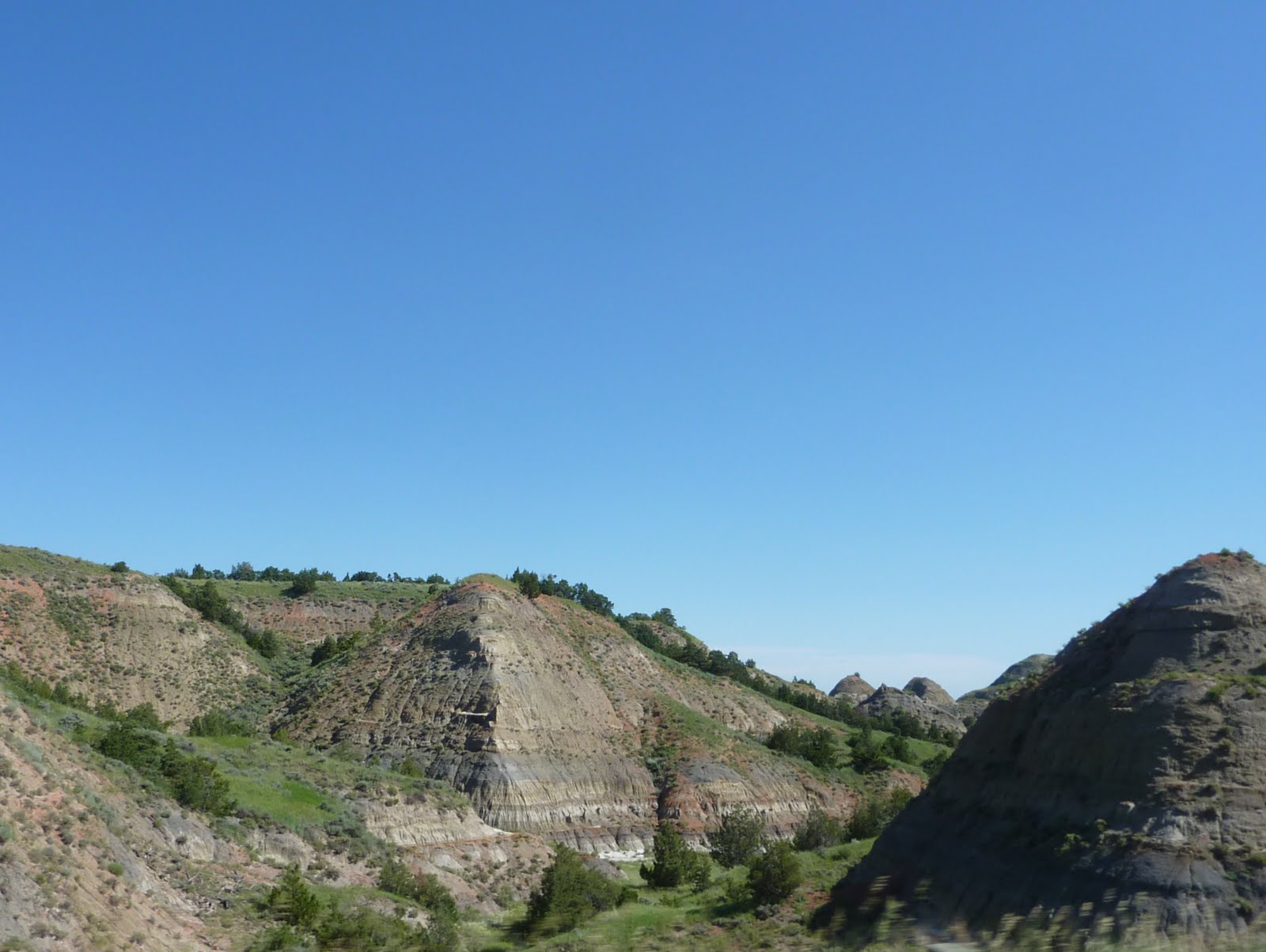
Most of North Dakota, to this point has had the typical great plains look that you would expect. However, once we hit the Roosevelt NP area, the landscape changed to more of a "bad lands" type of terrain. A nice change after looking at mostly prairie grass for the last day or so.
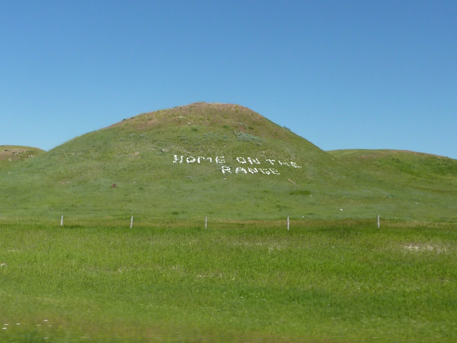
We passed this sign (sorry for the fuzzy photo) as we got toward the far western edge of North Dakota. Curious, I did not see buffalo roaming, nor deer or antelope playing? In addition, that is the state song of Kansas, why is this sign in North Dakota?

Someone even took time to gather large rocks, carry them up the hillside next to the highway, and arrange them for our reading pleasure? I can only assume they were concerned that we might have missed the big green highway sign? Or perhaps there just isn't much else to do in this part of the country?
Finally, we reach Montana !!

We exited the highway to start our way across 350 miles of back roads toward Great Falls. A quick stop for fuel, and that "back roads" worry I mentioned earlier begins to set in... The gas station has a sign on the door indicating that they will be closing at 2:00 PM due to the holiday. I was surprised to see this, considering that this is a station right at a major highway exit, and there are not many exits in these here parts ! Hmm, just how remote will these back roads be?
Our concern increased when, after a quick check of our maps, we realized that there were only a couple of tiny towns along the entire 350 miles we had yet to cover. These towns were anywhere from 60 to 130 miles apart, and looked like the types of towns with one intersection, a post office, and a mom-and-pop gas station. The wing pulling the trailer has about a 180 mile range, so if one of those 130 mile spans ends in a town with closed gas stations, we have an issue. I guess if the gas station is closed, we can only hope they have some lodging available :):)
It is amazing how much land is out here, with virtually no indication of habitation. We easily covered a hundred miles at a time without seeing anything except another car or two heading down the roadway.
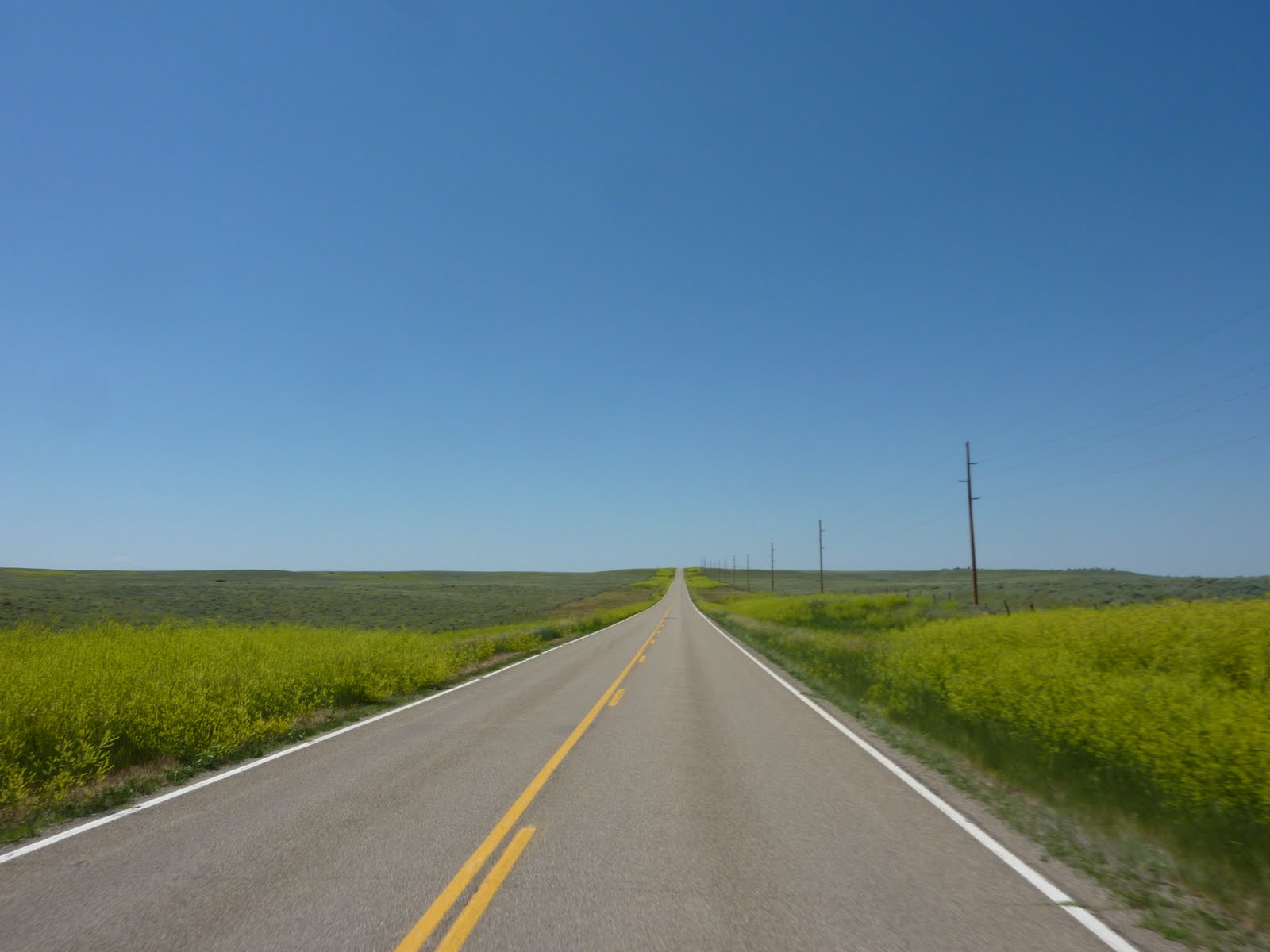
Here is a shot in the direction we are heading, nothing but prairie as far as you can see....
Here is a shot showing the area behind us... again, nothing but prairie as far as you can see...

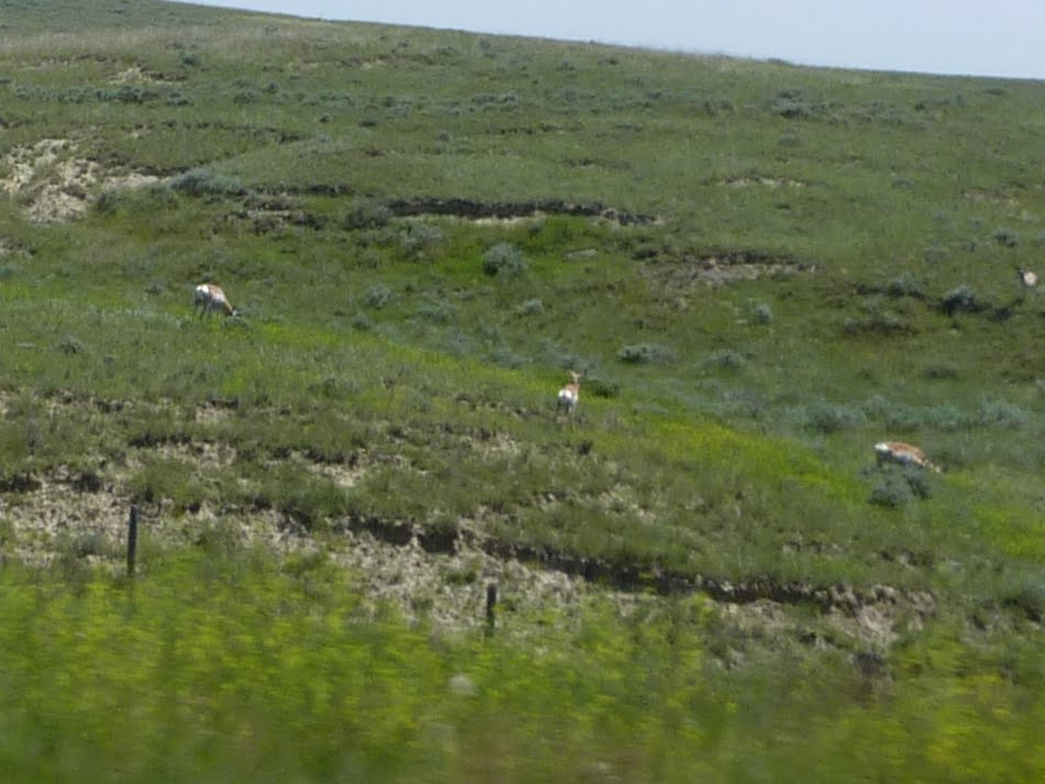
We did spot some life along the road at one point. These guys below are prong horned antelope out grazing along the roadway. Perhaps they were not told about the North Dakota "Home on the Range" playground we passed earlier? They must of also not read the rocks on the hillside?
Another shot of the huge expanse of land out here... I guess this is why Montana is nick named "Big Sky" country?

Another 100 miles down the road, and still nothing around... A quick check of Wikipedia shows that Montana has the 3rd lowest population density in the United States (the state ranks 4th in area, but 44th in population).

One of the small towns had only one gas station, and sported a single island with a whopping 2 pumps. the whole atmosphere reminded me of Mayberry. The attendant even ran out as we pulled up and turned the pump on and off for me. He was a very nice gentleman, so I refrained from calling him Gomer. The display on the pumps were the old reel type, no digital readouts or credit card readers here. In the end, we did find gas available in each of the little towns we rolled into, and we made it to Great Falls Montana without running our tank dry.
One other point to mention, is that Montana sure has its share of flying critters, and they grow them pretty big here too. It took a lot of cleaner and scrubbing once we got to the hotel.

Tomorrow we head to Glacier National Park. We chose this time of year for our trip because we wanted to travel across Going to the Sun Road through Glacier. GTTS road is only open for roughly 2 months each year due to snowfall. GTTS road is also the only road that goes completely across Glacier NP. The road is typically opened around mid June.
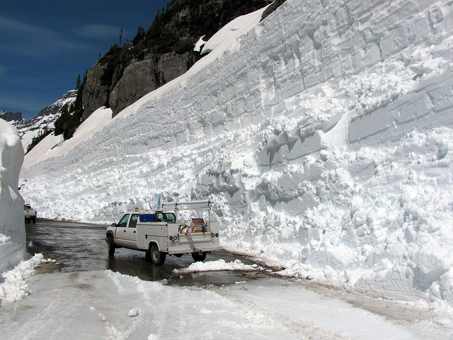
Guess what.... record snowfalls this year, including a huge snowstorm in early June have kept the road closed near the top (Logan Pass). The road is about 53 miles long, and they are still trying to clean the last 2-3 miles of roadway !!! The road up in this area (Rim Rock-Logan Pass-Big Drift) has up to 40-50 feet of snow cover. That is not a typo, I mean 40-50 feet. You can check out the details on what it takes to clear GTTS road each spring, at the national parks website.
Here are some photos from the national park site. These photos were taken on JULY 1st (just last Friday)!!
You can see below, they have a "pioneered" road cut in the snow. If you look close (bottom left of the photo), you can see where the road bed is located. Looks like another 15-20 feet to clear to get to the asphalt.

Another shot of the crew working up near Logan Pass. There is a road under there somewhere.

Here you can see a Cat dozer that has gotten stuck in some of the softer snow.

This is a shot of the Rim Rock area... the crew has this area down to asphalt. The photo gives you an idea of the snow pack in this area.
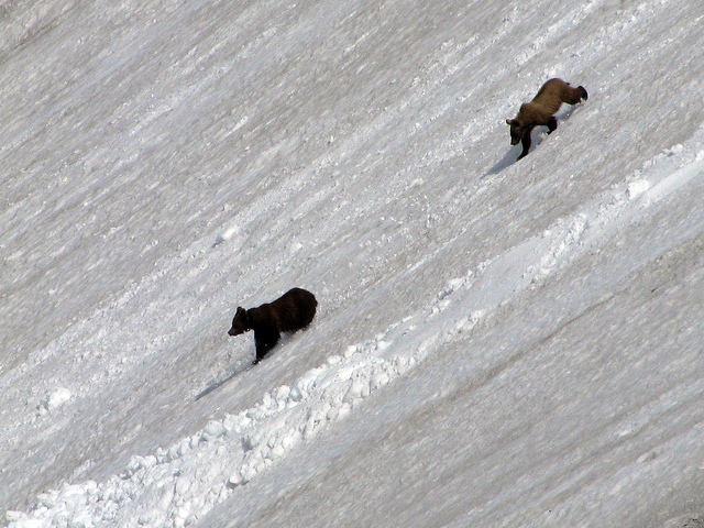
The plow crew took this photo of a couple of "locals" stopping by to watch the plowing action.
So, we will not be able to completely traverse GTTS road, but we can travel a portion of the way from each entrance (east and west). We will have to venture into the east end of the park, go as far as they will allow, back track, drive around the southern end of the park, then into the western entrance. This will make for a longer day, but we have no choice.
At this point, they are expecting that the road may not completely open until sometime in mid to late July. This will likely be a record date, as I believe the latest opening prior to this year, was July 10th in 1943.
To wrap up for today, we covered 453 miles, bringing our trip total to 1800 miles. It took us about 9 hours, including gas and food stops to get to Great Falls. Below is a map of our route from today.