Embedded Files
Where are Tom and Lennie Now? -Click Here For Our Current Location
Today was a long, HOT day. This area of the U.S. is having record setting high temperatures, and it takes a toll on us while riding all day. At one point, we were stuck behing a semi truck on a winding roadway. The truck was a refrigerated setup, and both Lennie and I spoke up at the same time... we were both trying to figure out how we could get him to stop, and let us into his trailer unit to cool off :) Enough whining...
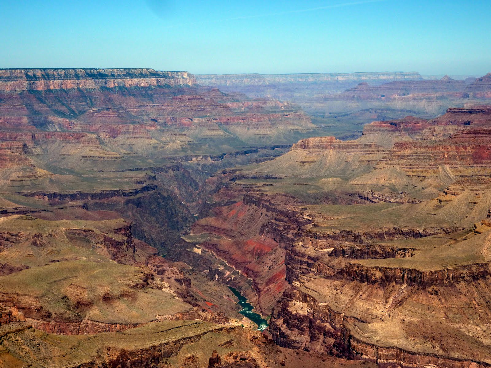
Today we left the South Rim area of the Grand Canyon. We headed out of the East entrance to the park, and did stop along the way for a few more photos.
One overlook area offered a good view of the Colorado River. You can see a small set of rapids near the bottom of the photo.
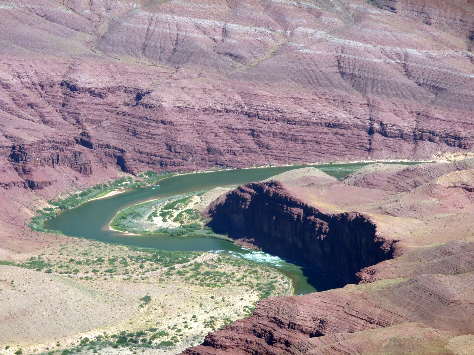
This area had a ton of different colors that just seemed to pop.
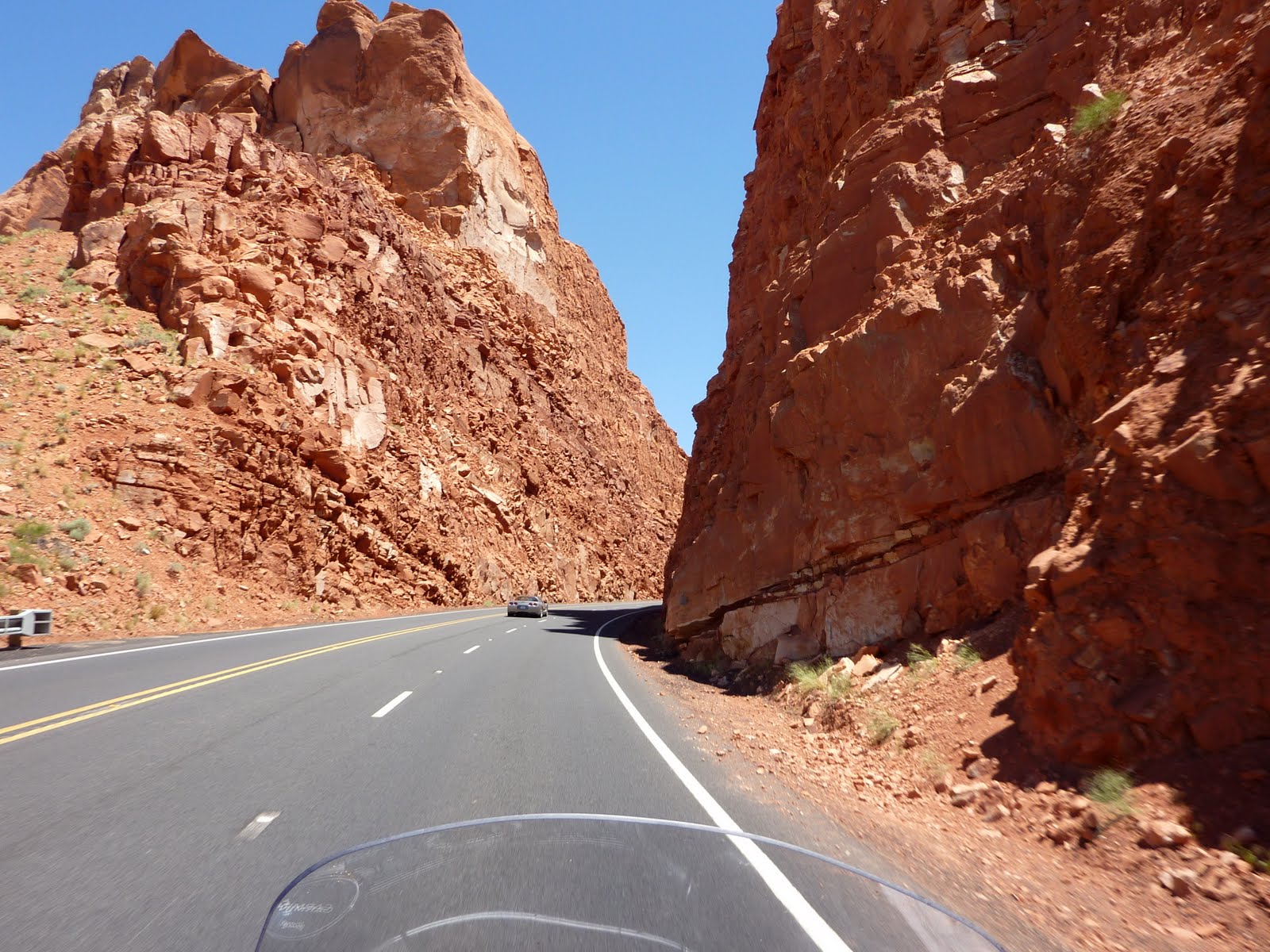
After leaving the park, we headed to Page, Arizona. Here is an pretty shot Lennie got on way into Page.
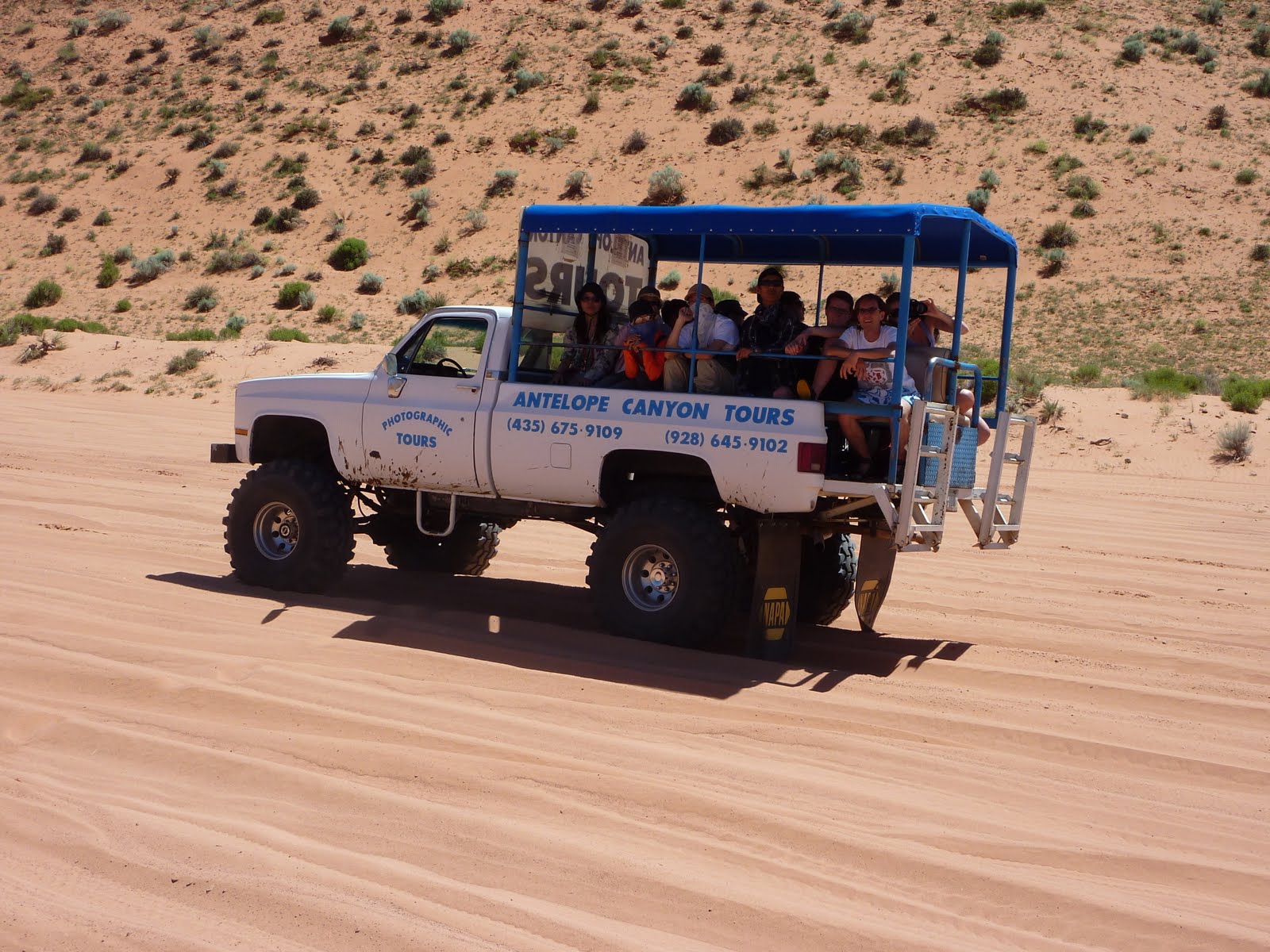
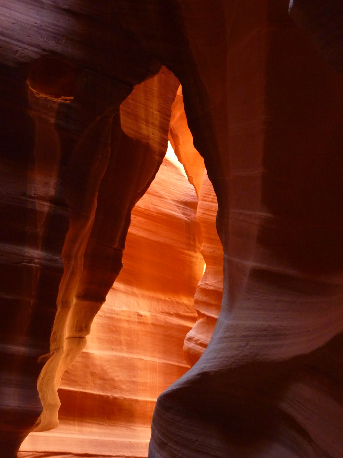
In Page, we took a tour of the Upper Antelope Canyon, which is a slot canyon. The canyon is on Navajo land, and you cannot get there on your own, you need to go with an approved tour company. Besides, there is a 3 mile ride in VERY DEEP SAND (over a foot deep in some places) to get to the canyon. The tour company uses a bunch of trucks that have been lifted and equipped with oversized tires. They pop some bench seating and an awning in the bed, and viola, you have a tour bus built for 12 :)
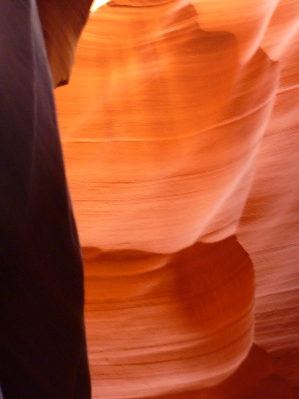
The canyon itself was formed by flood waters running through the sandstone. The canyon is about 1/4 mile long, and is about 130 feet deep. Most areas are 5-10 feet wide.
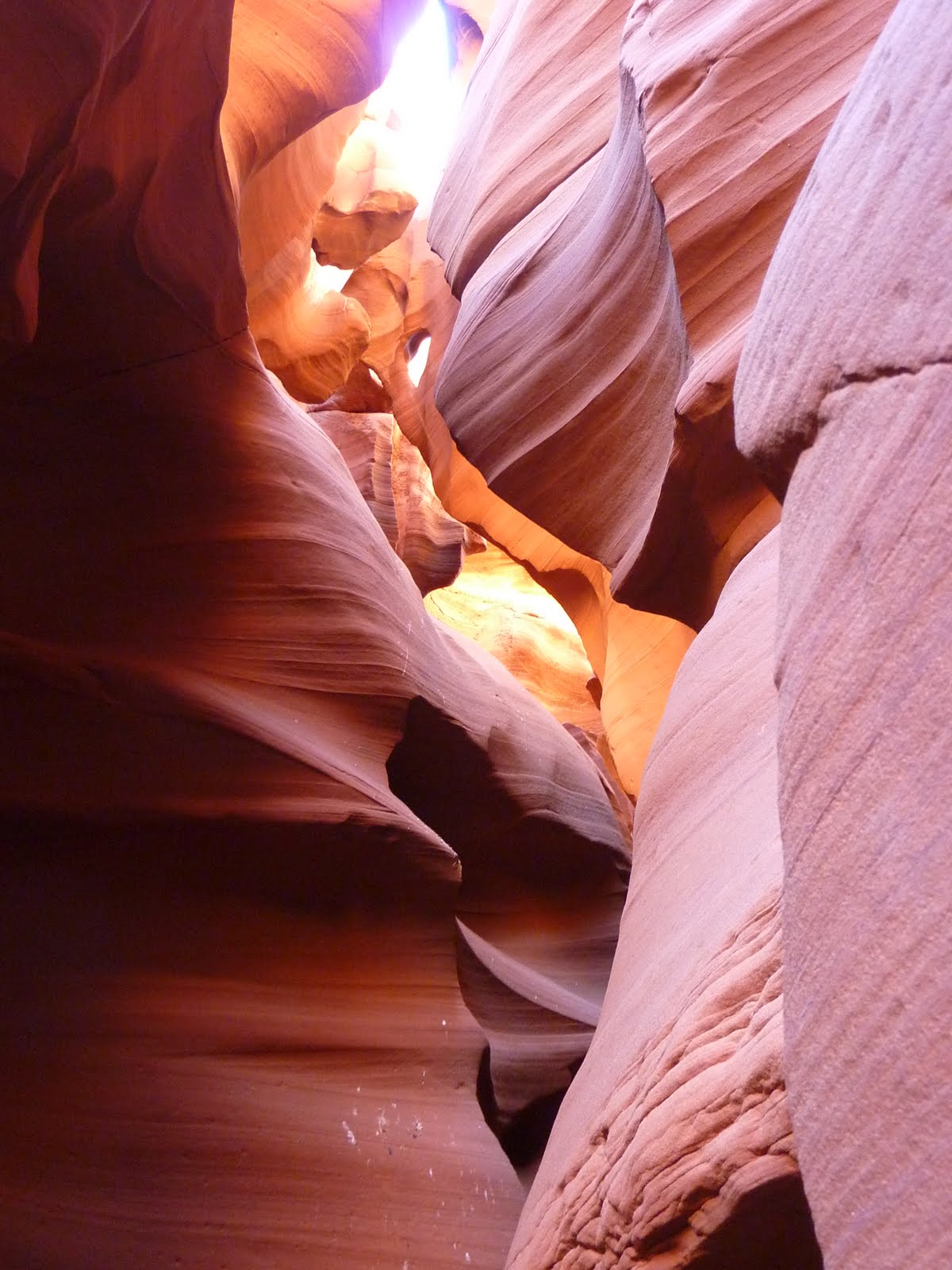
Sunlight enters the canyon from 130 feet above, and causes some incredible colors to appear on the canyon walls. Photos of this canyon have been on many magazines, including National Geographic.
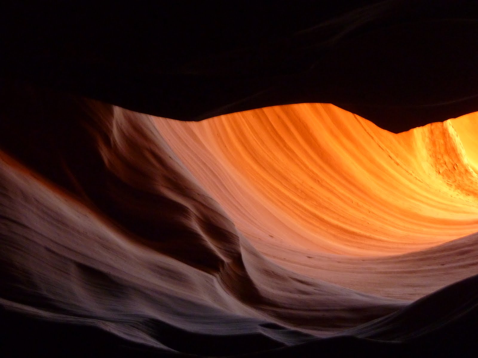
None of these pictures were taken with a flash.
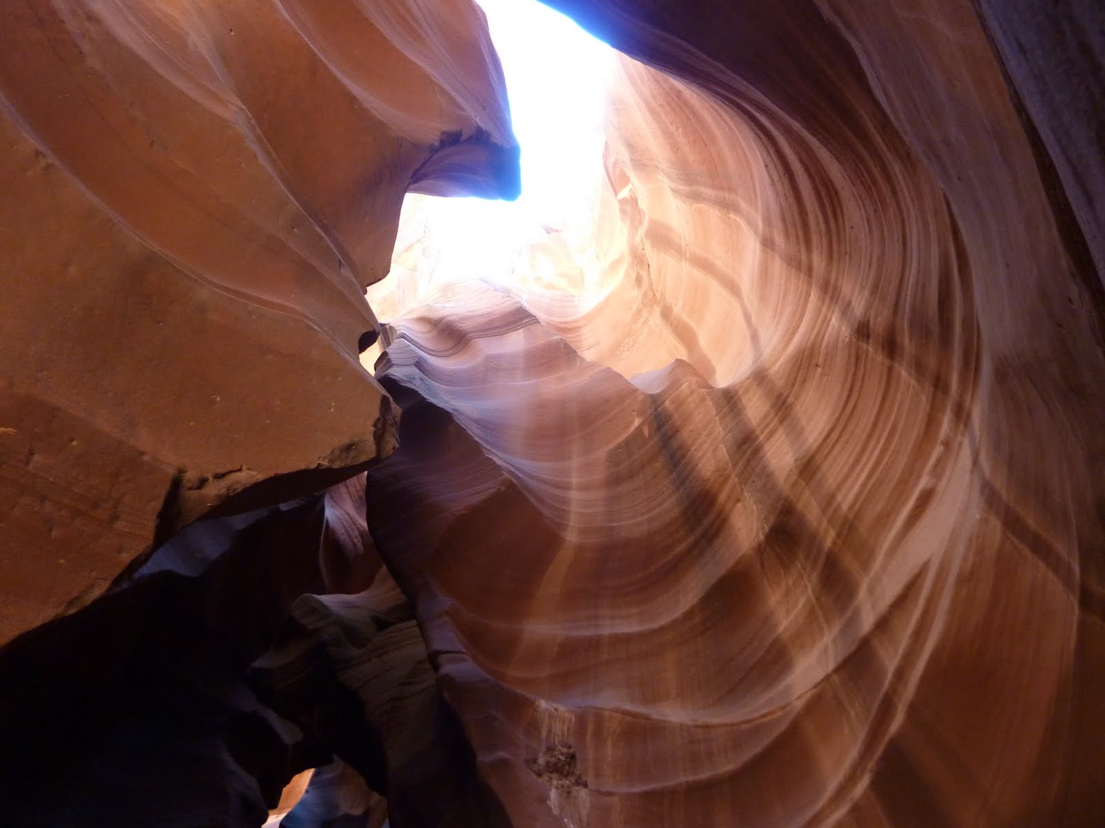
Some areas of the canyon catch more light than others.
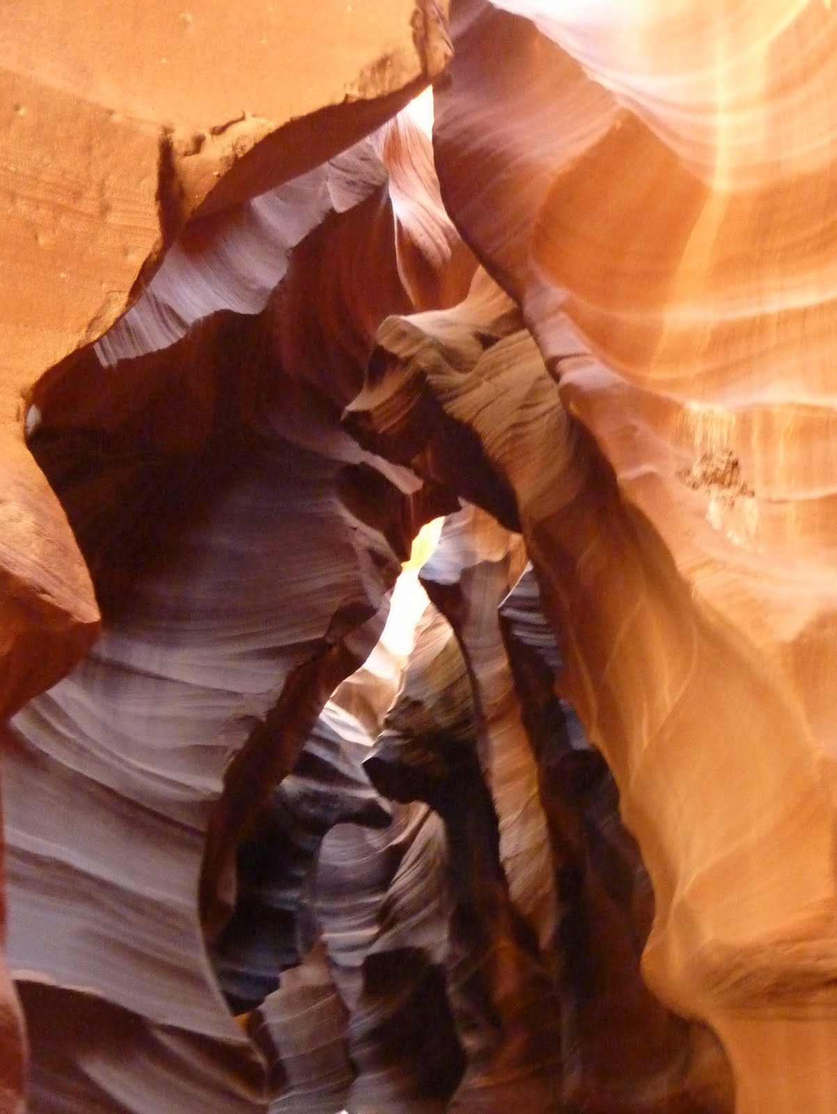
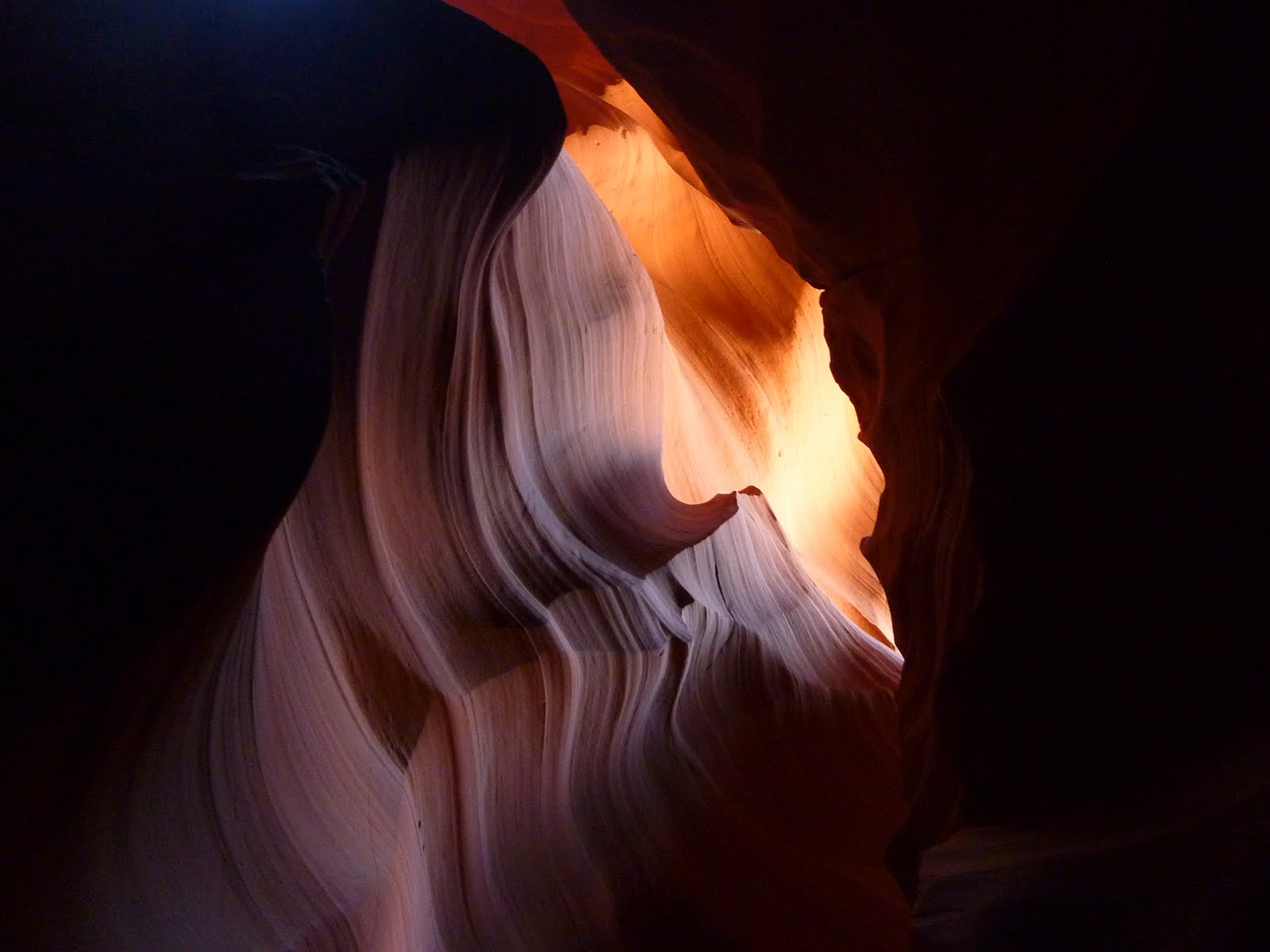
Some areas even end up with a blue or purple coloring as well. See the blue coloring in the upper right area of this photo?
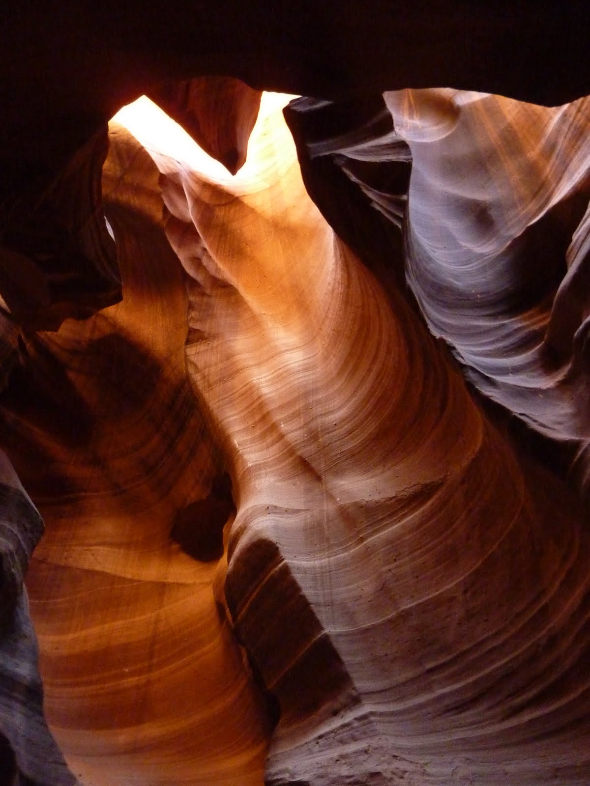
Here is another photo with a hint of blue.

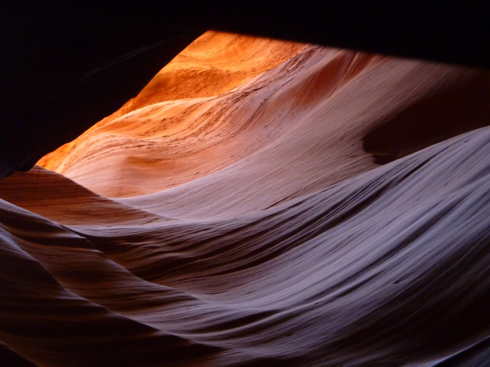
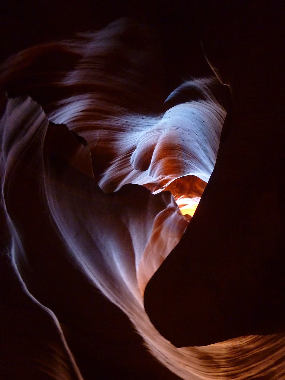
This photo was taken looking straight up from the canyon floor. This area of the canyon is called the "heart of the canyon". If you look close, you can see the heart shape. This photo also has a ton of color, including the blues and purples.
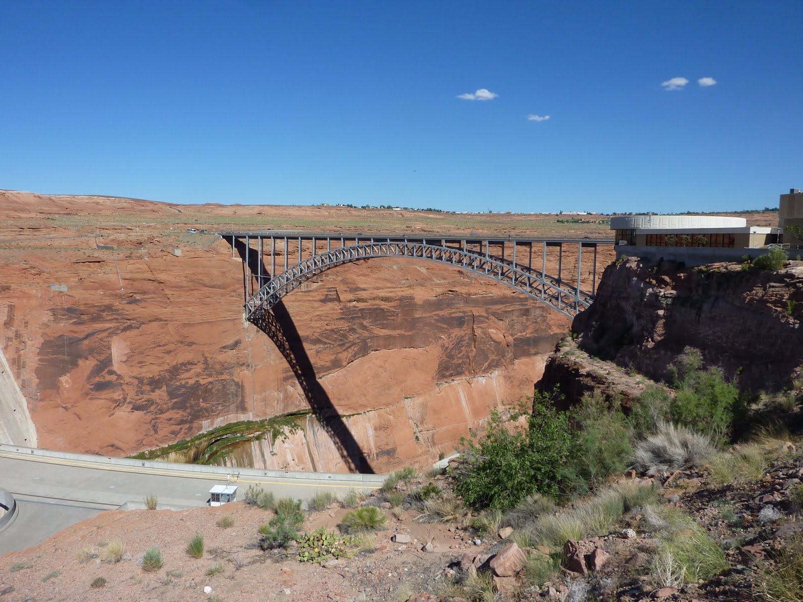
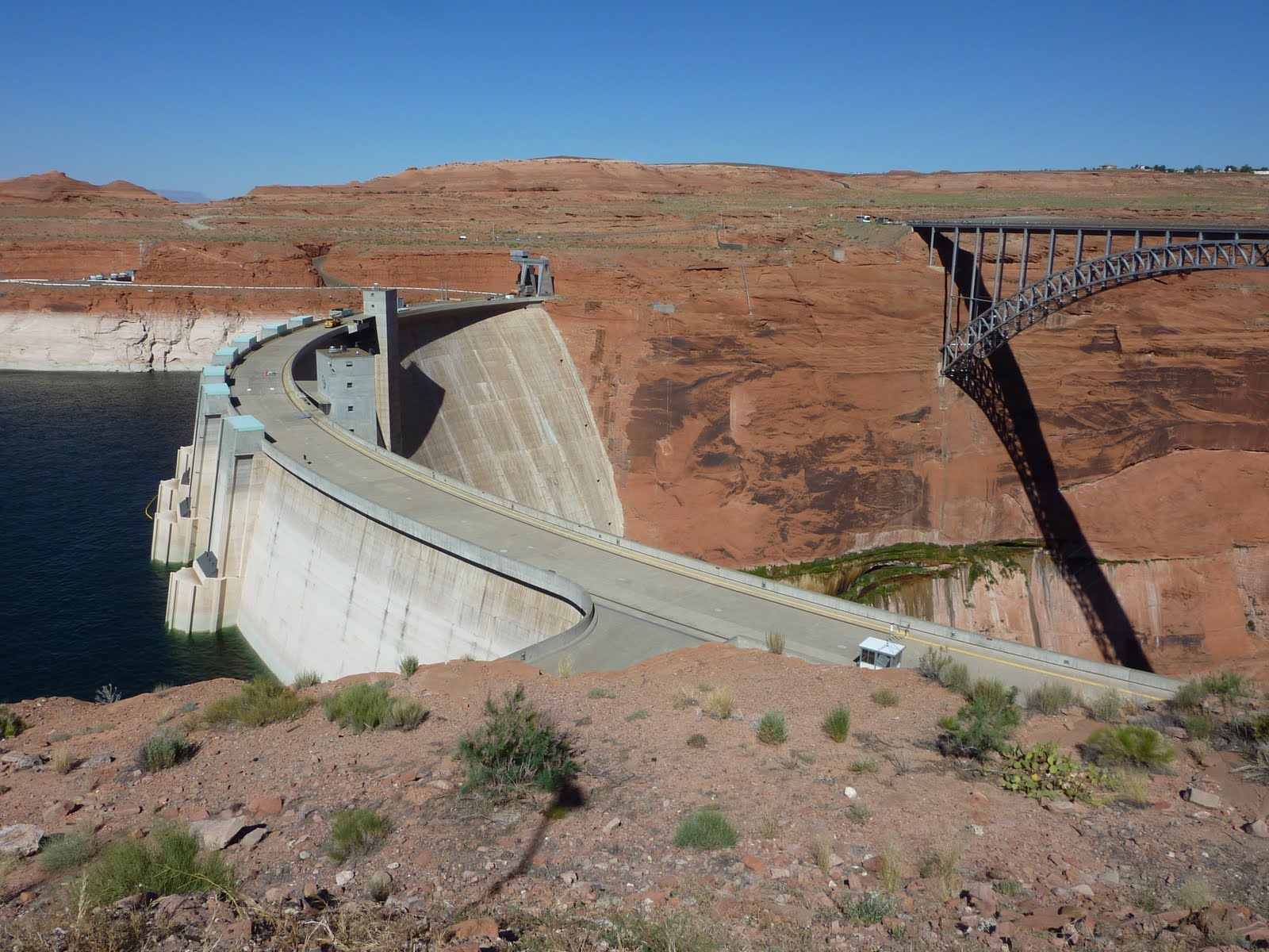
After the canyon tour, we headed off to see the Glen Canyon Dam. The dam is 710 feet tall, and over 1500 feet wide. It holds back the Colorado river to form Lake Powell. The bridge below is the roadway crossing the Colorado River. This bridge is 700 above the riverbed, and is the 4th highest bridge in the U.S.
Here is the top of the dam.
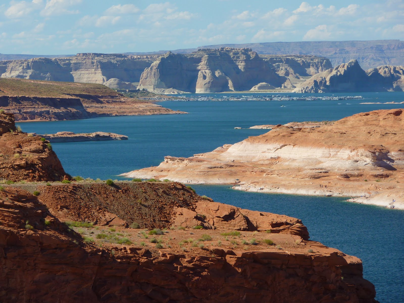
This is a photo of Lake Powell from near the top of the dam. Lake Powell is the second largest man-made reservoir in the United States, behind Lake Mead which is held back by the Hoover Dam.
The dam was completed in 1963, and it took 17 years for Lake Powell to reach its normal water level.
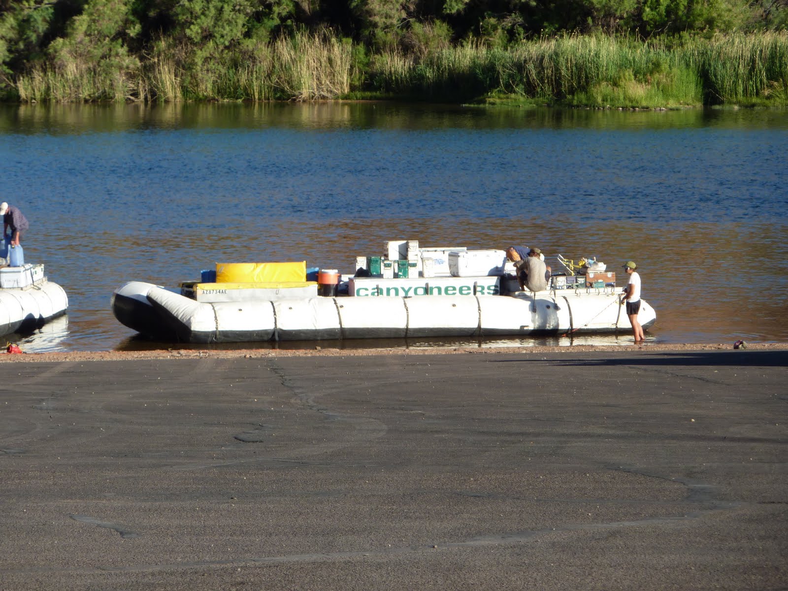
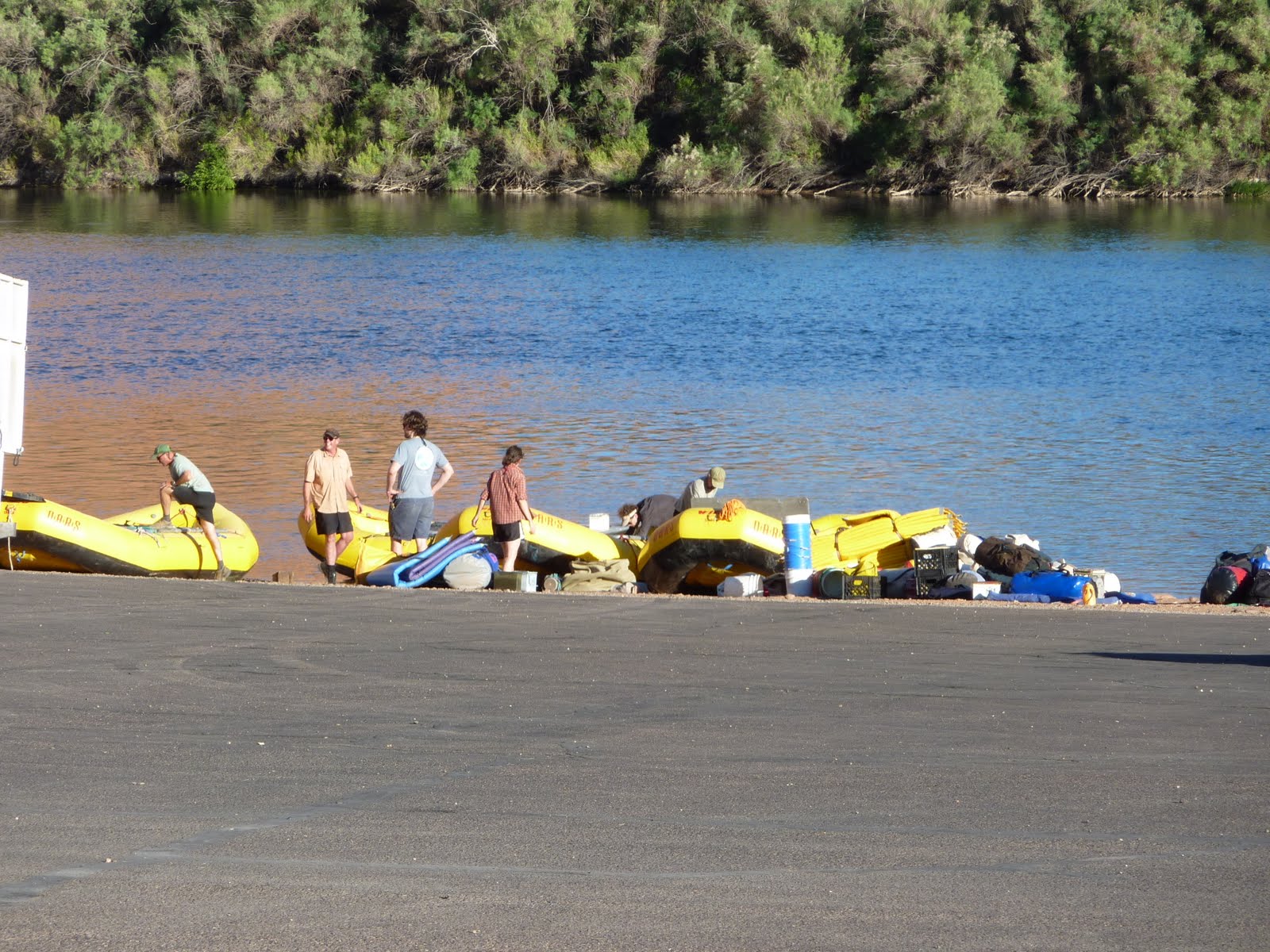
After the dam, we headed to Lee's Ferry. This is the main "put-in" for rafting trips on the Colorado river through the Grand Canyon. It was so hot, we spent 1.5 hours here just sitting on a shaded picnic table to get out of the heat. We watched as a rafting company worked on preparing rafts that would be used the next morning for a week long trip. They had two HUGE rafts that were to carry only provisions, food, camping gear, etc. One of these two rafts can be seen below, and the workers standing nearby give you an idea of the size.
They were also starting to inflate the actual passenger rafts to get them ready for the trip as well.
I could not convince Lennie, but I wandered down to river to check out the water. It was cold, but felt refreshing on such a hot day.
Our route for today is shown below. We covered about 287 miles, bringing our trip total to 3125.
Google Sites
Report abuse