Embedded Files
Where are Tom and Lennie Now? - Click here for our current location !
Add your comments and feedback here!
Day 19 will take us out of Nevada, and into Utah. Like yesterday, it will be a fairly short ride, and I am not really sure why that is :)
You see, Lennie and I planned out most of our routes for this trip back in February. We could have chosen two ways to get from Reno NV over to the eastern side of Utah. We could have traveled route 50, which looks like a fairly high speed (likely two lanes most of the way) route, but with VERY little along the way. Or (the route we chose), stay on I-80 until Salt Lake City, then hit the back roads. I think we made a reasonable choice. However, I cannot for the life of me figure out why we planned three days from Reno NV to Steamboat Springs CO??? The trip is a little under 900 miles, a fairly easy two day ride. Instead, we broke it into three ~300 mile days? Not sure what we were thinking back in February? Oh well, rather than re-book hotels, we are just taking our time getting there, and enjoying the ride. Actually, with the heat, the shorter days are a welcome relief.
While making our way across the remainder of Nevada, we followed this old Ford pickup for a while. He was making pretty good time, and kept up with the 75 mph speed limit. I followed him for a while, hoping no parts would fall off in my path :)
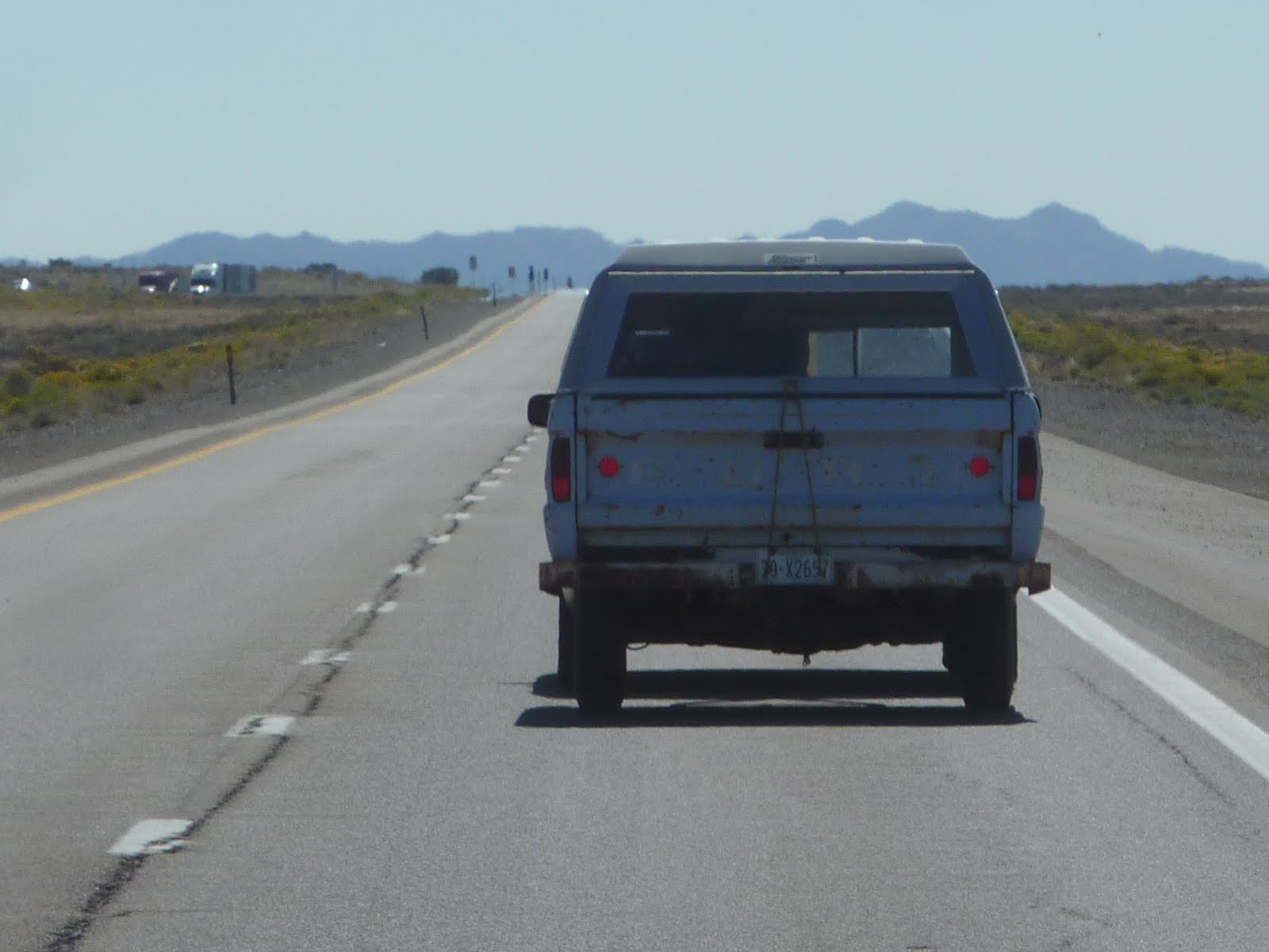
A while down the road, we noticed our Ford friend was really only partially a Ford, and mostly a Chrysler Pacifica! How does that old saying go... don't judge a truck by it's tailgate?

One of the things I hate the most while traveling by motorcycle is road work. At least traffic was moving pretty good through this mess.

A second thing I hate the most while traveling by motorcycle is truck re-treads flying around or laying in the road. I think these things should be illegal on the highways. Even in a car, those giants hunks of steel reinforced rubber can do some real damage. Perhaps they should make a law that says whenever a truck throws a re-tread, the driver is required to pull over, jump out, dodge his way through highway speed traffic, and pick up every last piece of tire. Maybe that will make them think twice about re-treads. Oh well, the drivers and trucking companies save a buck, and put you and I at risk instead.

Once we cross the Utah border, the scenery seems to instantly change. We have entered into the Great Salt Lake Desert. Everywhere you look you see what looks like white sand. In addition, there is actually standing water in the highway median, and on each side of the highway. That white sand, not sand, actually it's a packed layer of salt.

Below is a better shot of the standing water along I-80. We are also very close to the Bonneville Salt Flats. Bonneville is an area of densely packed salt, where folks often try to break land speed records. Despite being wrongly associated with drag racing, setting speed records at the Bonneville Salt Flats is racing of a unique sort —no "0-60" records are broken here. Since the salt is somewhat slick, maintaining traction is a major concern of every racer. Cars start slower than many expect, but they make their way up to some very fast speeds. Given the great size of the flats, there is plenty of room for these race cars to reach their full potential. There are two to three tracks, depending on the condition of the salt, set up for each speed event. The shortest is usually a 5-mile course while the long-course usually runs 7 miles. Depending on the class (there are hundreds of classes that participate, from motorcycles to streamliners to various types of cars), racers are assigned to courses accordingly. Some classes, like the 49cc motorcycles, have records set at under 100 mph while others, such as high-powered streamliners, reach speeds of 400-500+ mph.

Below is a strange sculpture along the side of I-80. After a little research I found that it is an abstract artistic sculpture called "Metaphor: The Tree of Utah".
Swedish artist Karl Momen created the 87-foot high tree between 1982-1986. He financed the project himself to bring bold color and beauty to the stark, flat, salty landscape. The sculpture is made of 225 tons of cement, almost 2,000 ceramic tiles and five tons of welding rod, and tons of minerals and rocks native to Utah.
The location is interesting because the harsh environment here hindered many travelers in pioneer times. Members of the ill-fated Donner Party were tragically delayed in this area before their awful demise in the Sierra Nevada mountains. During WWII, the crew of the Enola Gay practiced bombing runs over the Great Salt Lake Desert before proceeding to Hiroshima to end the war.
Interesting what you find in the middle of no where.

We also passed these two white items in the sky. They looked like blimps, but never appeared to move. Again, a little research, and I find this...
We happened to be passing by the Dugway Proving Ground, which is a US Army facility. The Dugway's mission is to test US and Allied biological and chemical weapon defense systems in a secure and isolated environment. DPG also serves as a facility for US Army Reserve and US National Guard maneuver training, and US Air Force flight tests - mostly from nearby Hill Air Force Base in Ogden Utah. DPG is controlled by the U.S. Army Test and Evaluation Command (ATEC). The area has also been used by US Army Special Forces for training in preparation for deployments to the War in Afghanistan.
The white items in the sky, they are radar blimps. I found an article from an online Salt Lake City newspaper that talks about the blimps.
The ability to fly fast and stealthily are anchors of the military's quest for air superiority.
So how does a blimp, the size of a football field, that's tethered to the ground fit in to that equation?
The Army and defense contractor Raytheon are hoping the radar system mounted in the anything-but-stealth blimp — often seen by motorists driving on I-80 — can be a defense against incoming cruise missiles and other threats that are too close to the earth to be seen by ground-based radar systems.
"It goes up to 10,000 feet. It can track airplanes, cruise missiles, boats, up to 100 miles and around mountains," said Mark Rose, program manager for Raytheon's Joint Land Attack Cruise Missile Defense Elevated Netted Sensor System, or JLENS.
Airplane-mounted radar systems do the same thing, but at a much higher cost. The airplane crews also have a limited amount of time in the air before they have to land.
The "crew" of the blimp, on the other hand, is on the ground and communicates with the radar equipment aloft through cabling in the tether that keeps the pilotless, engineless blimp from floating away.
In the air, the blimp can be on duty 24/7 for as long as a month, "unlike an airplane that has to come down often," Rose said. JLENS is an early warning system. In a battle setting, it works in pairs, with defensive radar in one balloon and a second radar system in the other that helps warplanes and ground forces find targets.
The blimp's own defenses against attack are twofold: "Because of its range, its ability to look out hundreds of miles, it is far back from the battle area," Raytheon spokesman Mike Nason said.
Up close, the helium that lifts the blimp is contained in small cells that can take direct hits without downing the craft. "It's not like a toy balloon that goes 'pop'. Even if it does get holes in it, it doesn't come down for weeks," Rose said.
Raytheon has been testing the new system on the Utah Test and Training Range for the Army at the Dugway proving Ground for the past year and has recently been testing the system at the White Sands Missile Range in New Mexico.
The test blimp in Utah's western desert is in the air most of the time, since endurance is part of the testing, Nason said. It is likely to remain visible to motorists for some time with testing scheduled to continue for another year.
Who'da thunk it ??

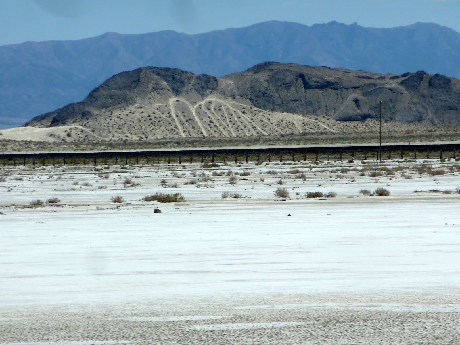
This interesting little mountain side was "tracked" from four wheeler's and dirt bike riders out having fun in the desert.
We eventually passed by a portion of the actual Great Salt Lake.
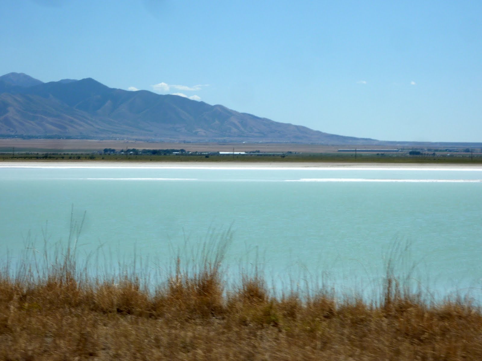
You can see a section of the lake in the photo below. The Great Salt Lake, is the largest salt water lake in the western hemisphere. In an average year the lake covers an area of around 1,700 square miles, but the lake's size fluctuates substantially due to its shallowness. For instance, in 1963 it reached its lowest recorded level at 950 square miles, but in 1988 the surface area was at the historic high of 3,300 square miles. In terms of surface area, it is the largest lake in the United States that is not a Great Lake.

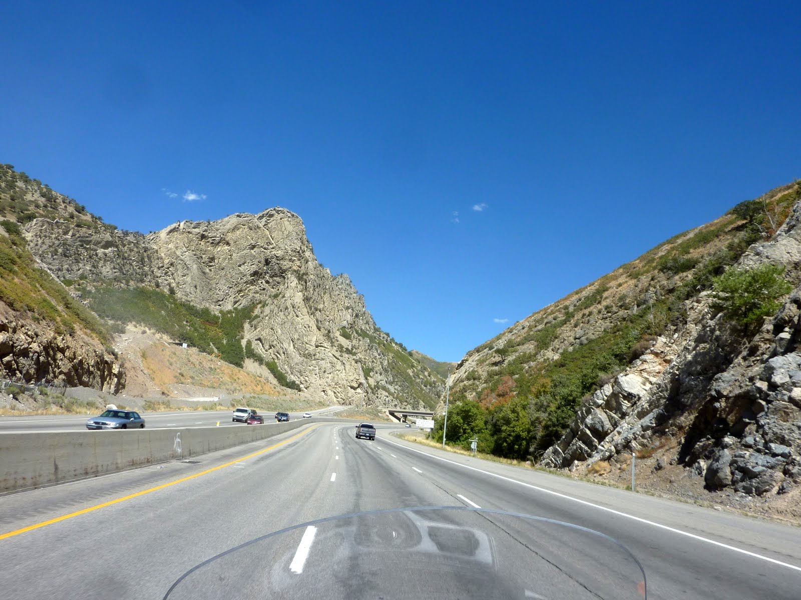
After passing the Great Salt Lake, we made our way through Salt Lake City, and out into the eastern portion of the state. Once east of of Salt Lake City, you start to climb your way into the steep Wasatch Range, which is the western edge of the Rocky Mountains.

The scenery in this area is magnificent, and as you can see from the blue skies, the weather was perfect.

Another shot of the scenery in the Wasatch range.
As you would expect, there are tons of ski resorts in the northern section of Utah. In the background below, you can see a small portion of the Park City Mountain Resort. The ski resort actually covers 8 mountain peaks. In 2002, the Winter Olympics were held in Salt Lake City, and a number of the skiing events were held here at Park City, as well as Deer Valley just a few miles down the road.
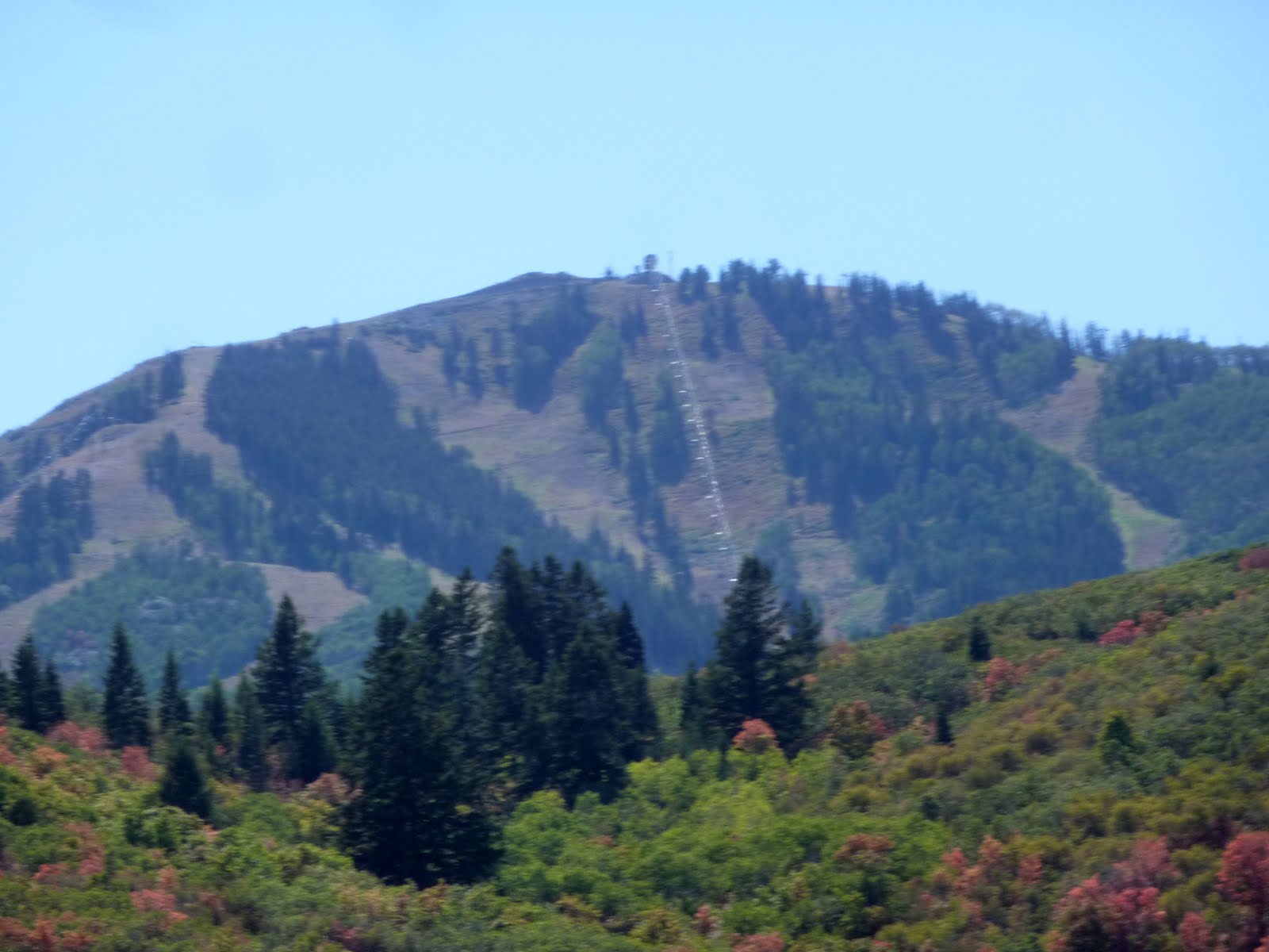
It looks like some fall colors are already starting to blanket this area of the state. Remember, the snow starts flying in the Wasatch in October!
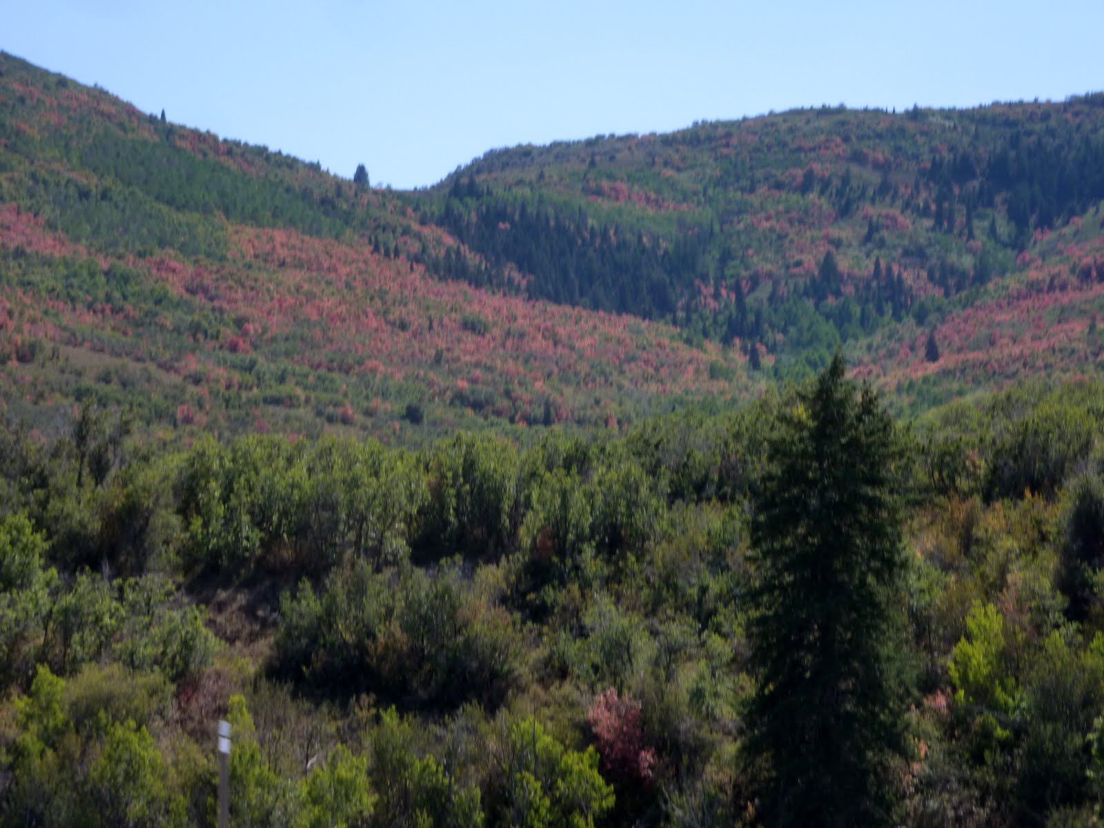
More of the fall colors just starting to pop.

Tomorrow we will actually get to Steamboat Springs Colorado. It should be a really nice ride, out in the mountains, and away from the highways.
Today, we traveled 277 miles from Elko NV to Heber City Utah. This brings the trip total to 4514 miles. Below is a map of the route from today.
Google Sites
Report abuse