Embedded Files
Where are Tom and Lennie Now? -Click Here For Our Current Location
We woke up this morning to sunshine, although, the weather forecast did say that there was a chance of thunderstorms later in the afternoon. We packed up the trailer and headed off to downtown Dallas to visit Dealey Plaza, the location where President Kennedy was assassinated.
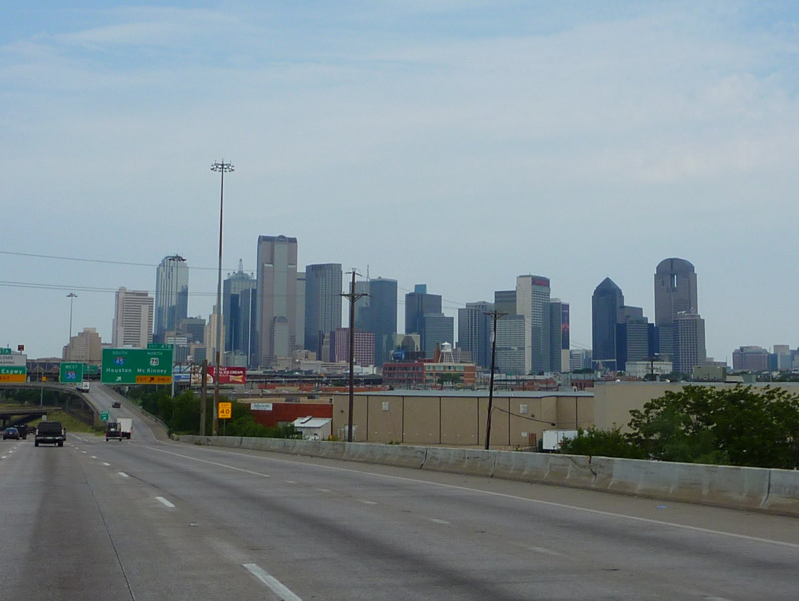
Here is a picture of the Dallas skyline as you come in from the east. I did not do any research beforehand, but I expected Dallas to be a much bigger city?
Dallas is only about 40 miles north of Waco, where those nutty Branch Dividians holed up and had a shootout with the United States ATF back in 1993. The shootout was followed by a 51 day standoff, then a huge fire that killed 74 people, including David Koresh, the leader.
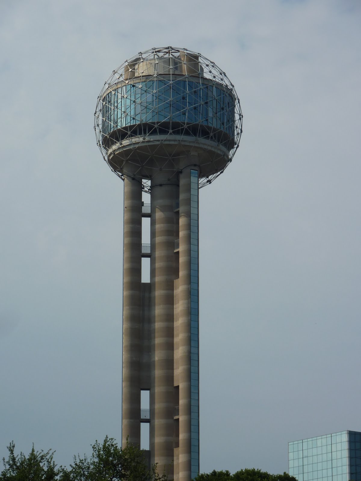
Below is a picture of Reunion Tower in downtown Dallas. Reunion Tower was built in 1978, and is considered to be one of Dallas' signature buildings. Reunion Tower is a 560 tall observation tower that was constructed as a part of the Hyatt Regency Hotel. The shaft of the tower is constructed from poured in place concrete and features four concrete cylinders. Three are placed on the outside in a triangular pattern and they house elevators that offer the passengers a view as they ride up or down. The center one houses stairs and mechanical shafts. The top of the tower is a three level structure, also constructed of poured in place concrete. Surrounding this top is a geodesic dome formed with aluminum struts. At the intersection of the aluminum members are 260 lights that are kept turned on most of the evening hours. In addition, at certain times during the evening, the lights flash to different patterns for a special light show.
,
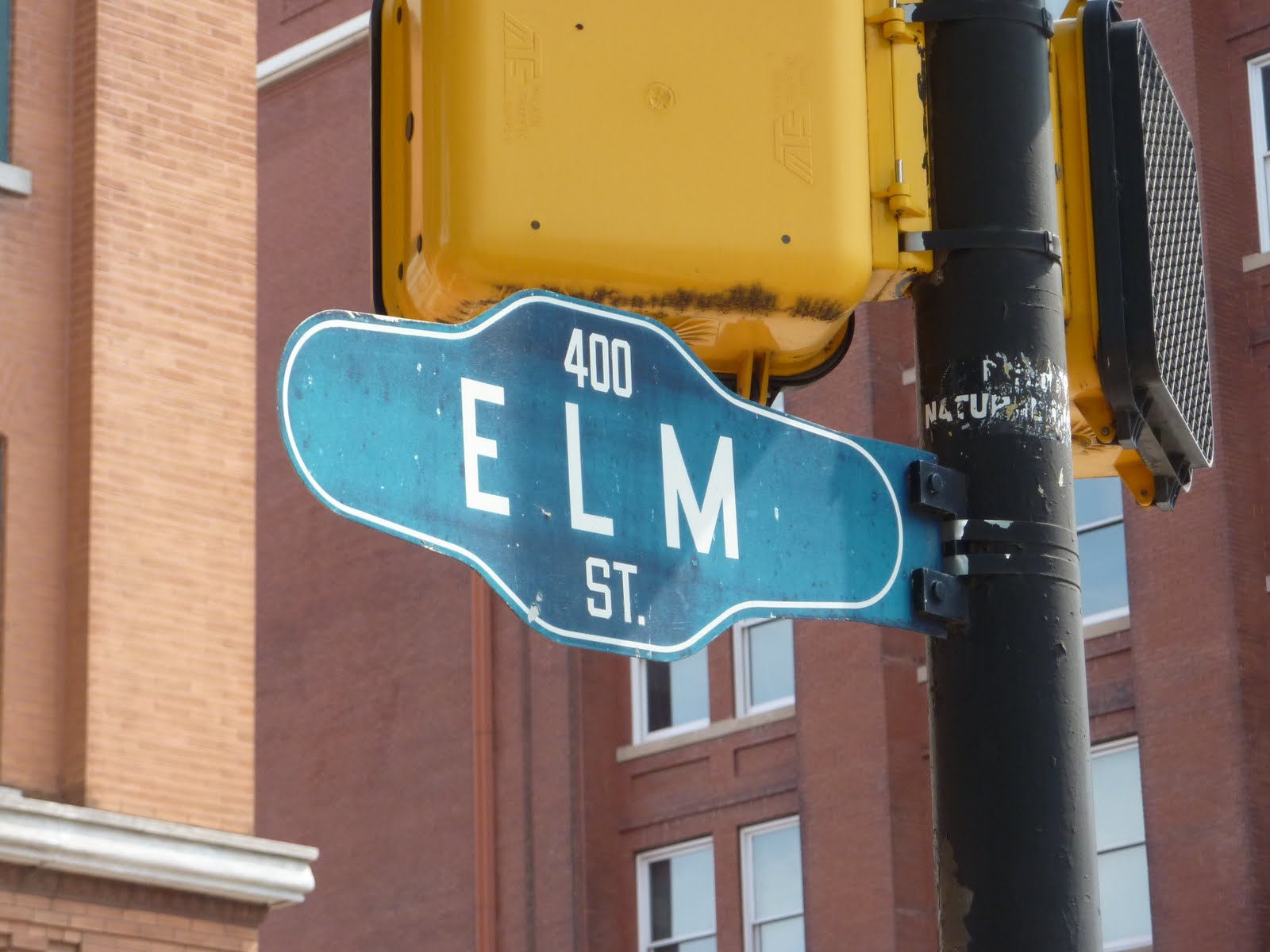
Here is a picture of an Elm Street sign in downtown Dallas. Elm Street is the location of the assassination of President Kennedy. The street signs in this area of Elm were left as they were back in 1963.
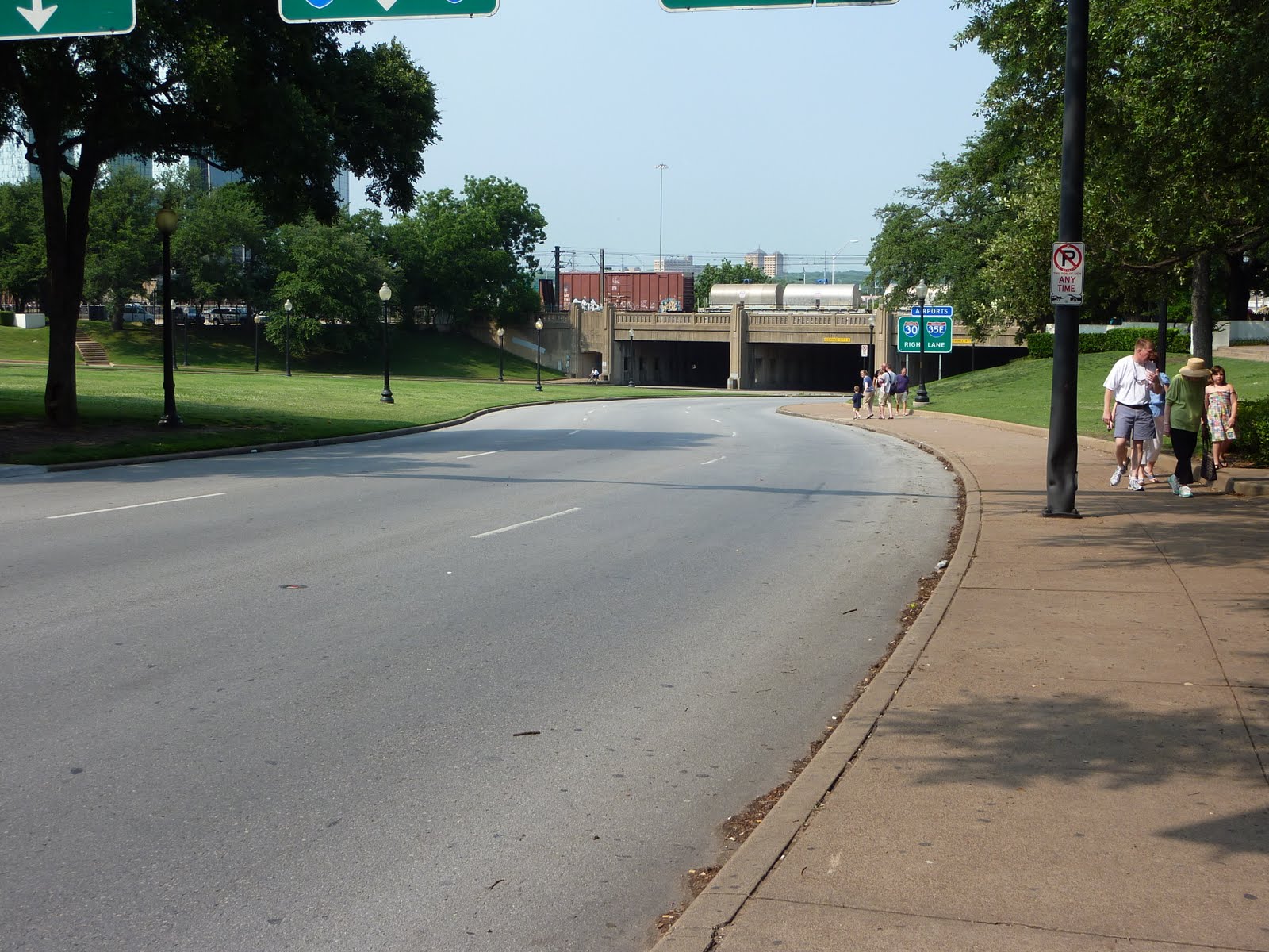
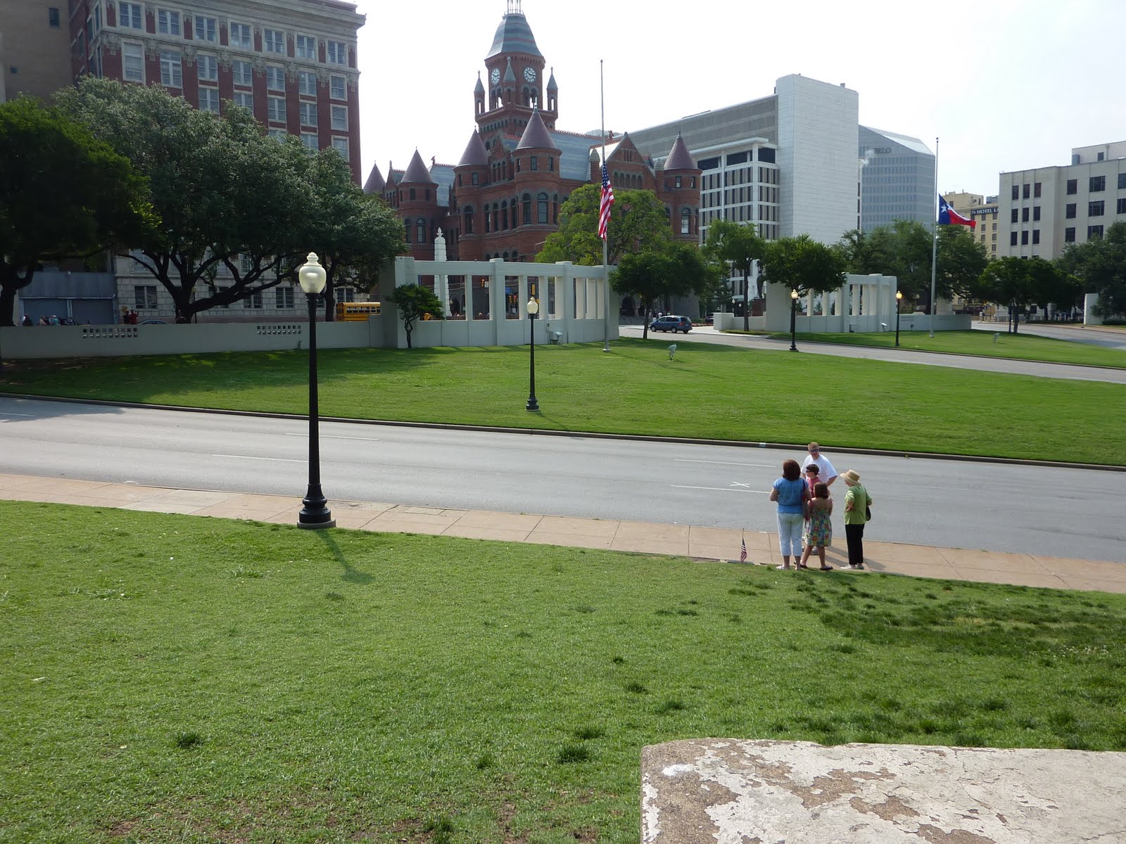
This is a photo of Elm Street, with the "grassy knoll" just ahead on the right. There are two X marks painted on the roadway, these are there to mark the location of Kennedy's limo when the shots were fired. You can see the triple underpass in the distance. The top of the underpass houses train tracks.
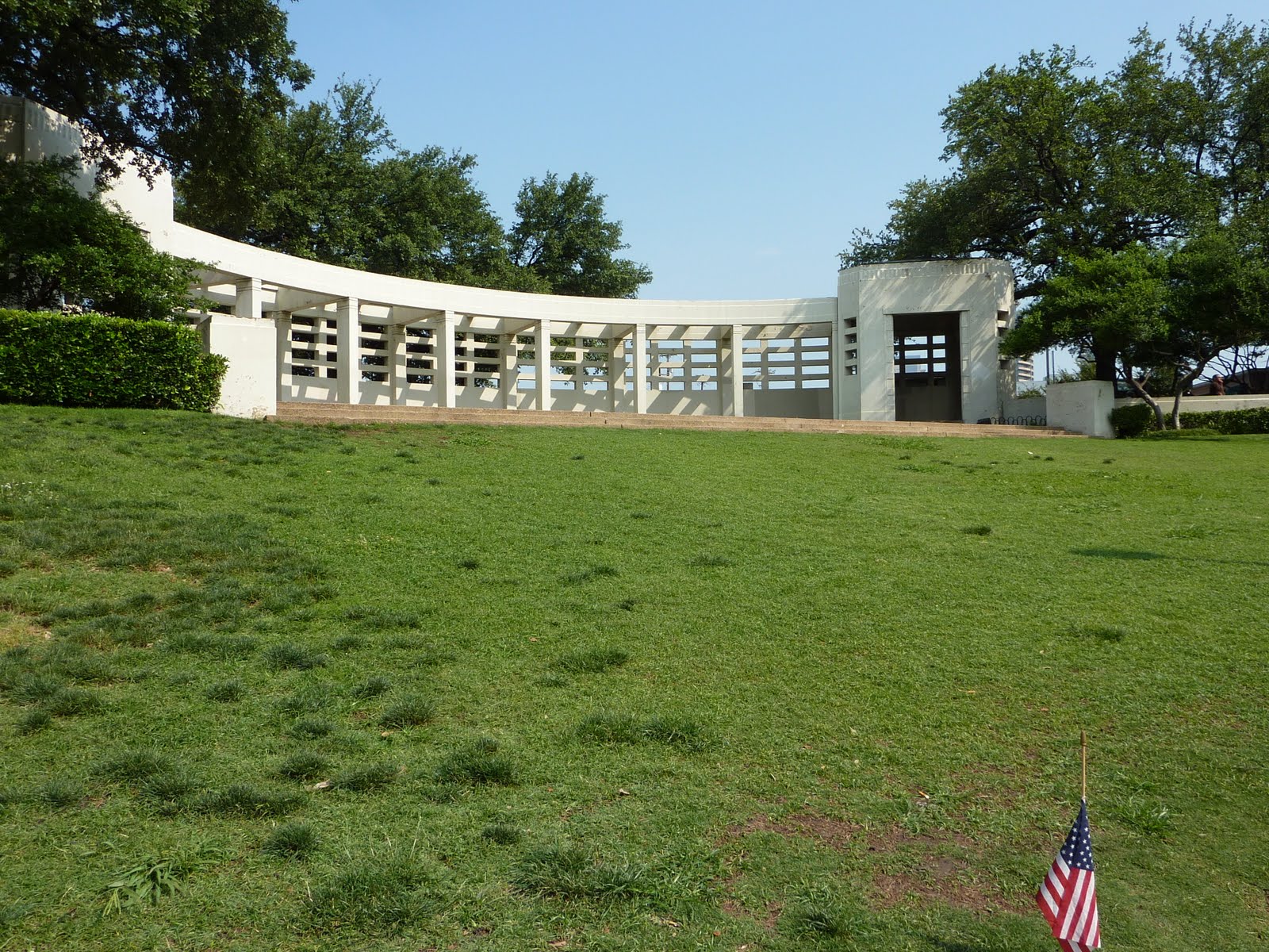
This is the memorial that sits upon the grassy knoll on Elm.
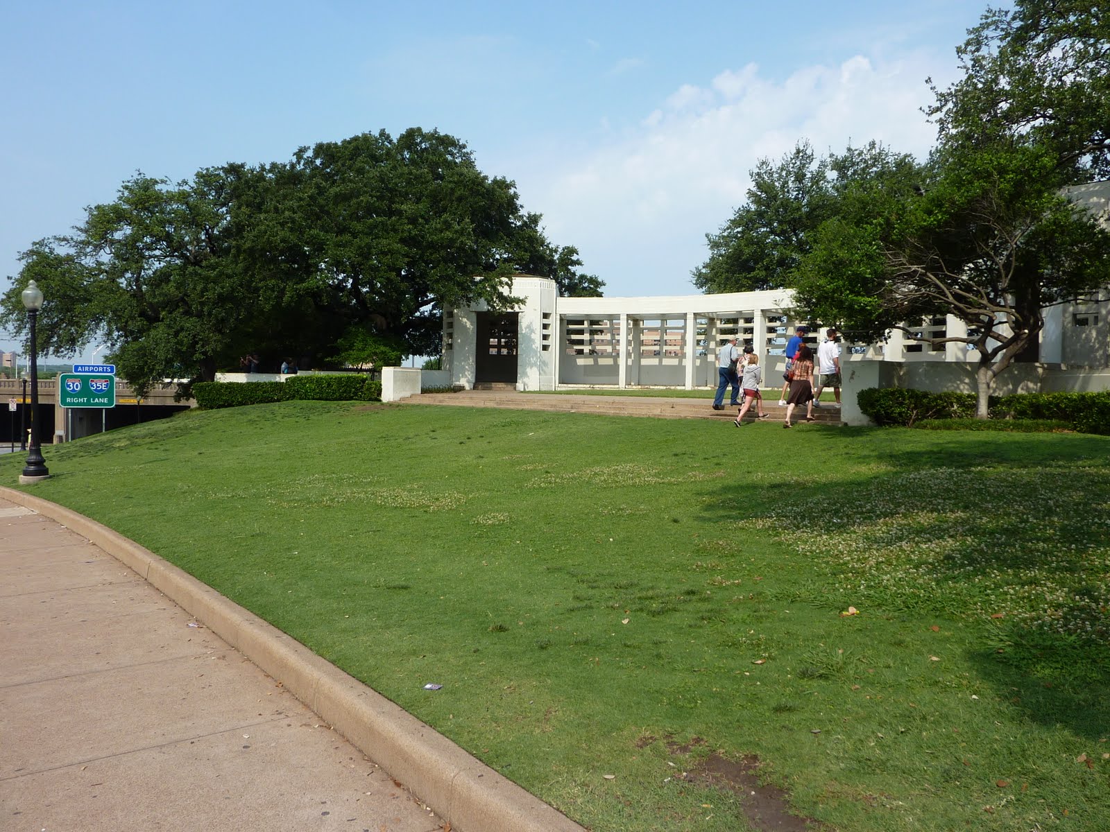
Another picture of the memorial.
This is the second X marking on Elm, and is the location in which the fatal shot was delivered to Kennedy.
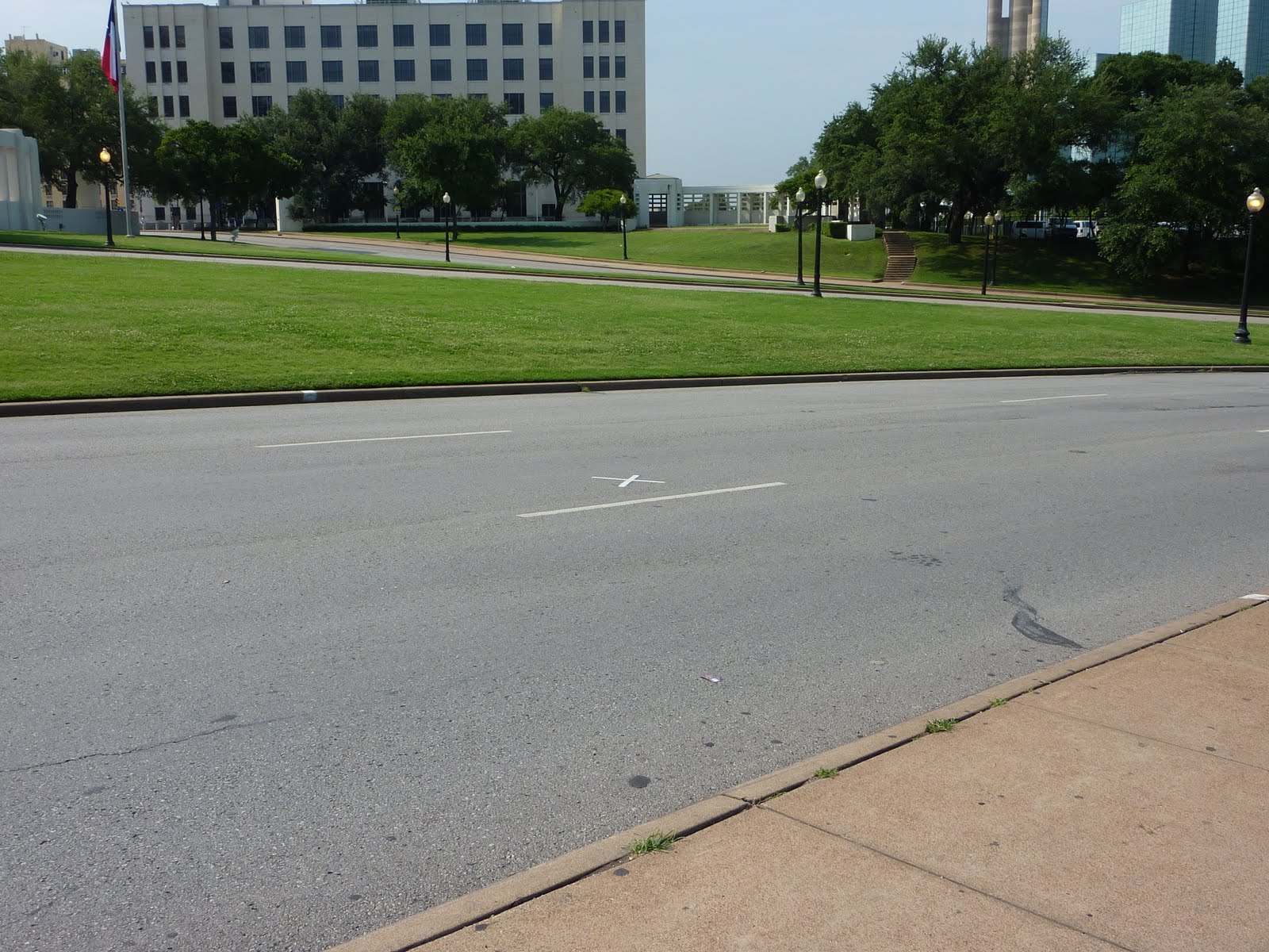
This is a view of the second X looking down from the grassy knoll area.
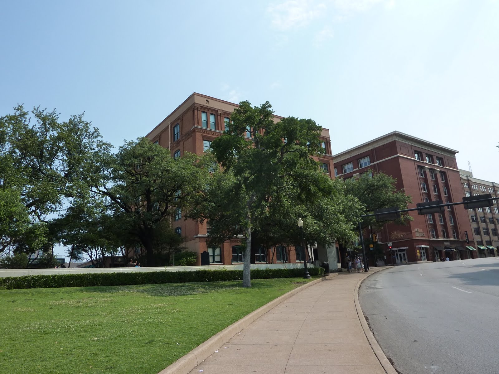
Below is a picture of the Texas School Book Depository, where Oswald fired shots from the 6th floor window.
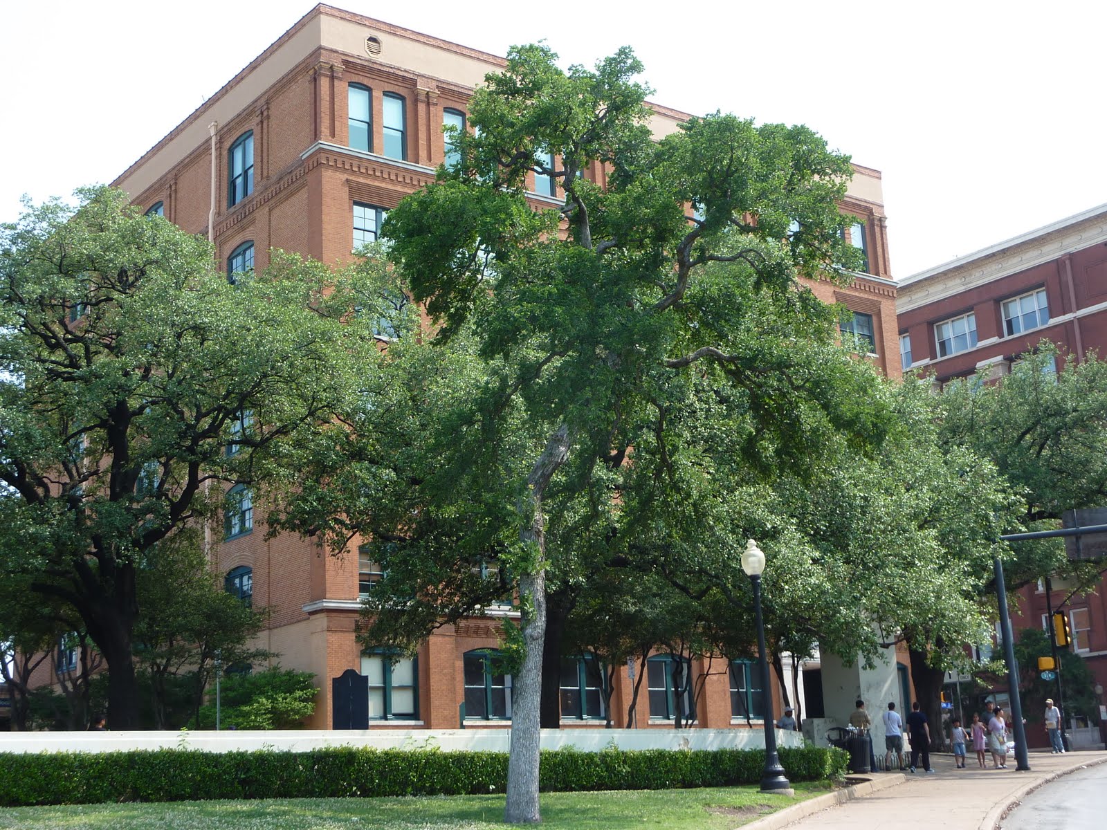
Another view of the Depository, from the general area of the second X mark on the street. I was surprised to learn just how close the building was to the limo path. Amazing that the buildings so close to the motorcade route were left unsecured. I guess it was many years ago, and attempts like this were not very common?
You can go up to the 6th floor and look out the actual window where Oswald fired. Unfortunately, we were there pretty early, and the building did not open for another 2.5 hours.
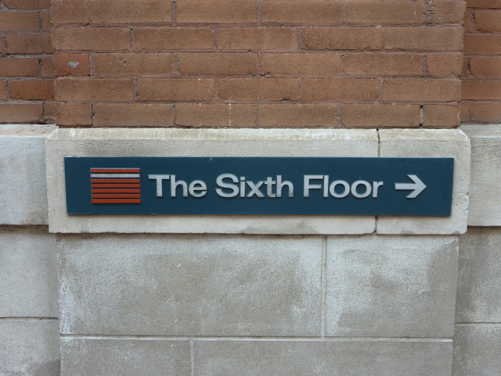
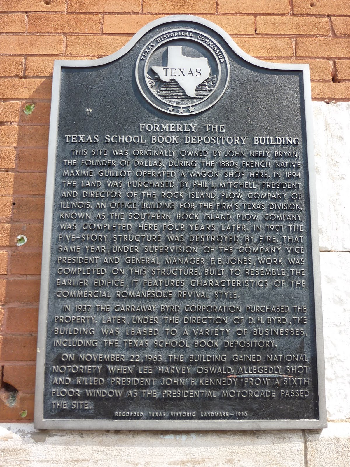
This is a plaque on the side of the Depository building. If you click on the picture, and then click on the picture again, it actually displays large enough for you to read.
Regardless of whether you believe in the "single shooter", the "magic bullet", the "second grassy knoll shooter", or any of the other conspiracy theories, it is still interesting to visit here, as it holds a major place in our presidential history.
After leaving Dallas, we traveled on to Roswell New Mexico. Remember those thunderstorms I mentioned earlier? About an hour east of Roswell, we were reminded. A huge storm cell loomed ahead, as we raced to get to the next small town for some shelter. With about 5 miles to go, the rain let loose, and lightning was striking all around. The front edge of the storm cell hit us with strong winds, and made it difficult to keep the bike in my own lane on the roadway. We trucked onward, and pulled into a gas station in Plains Texas. We parked the wing under the gas station awning, and hung out with others near the store front to watch the lightning show. Pretty impressive storm !! After about 20 minutes, the storm had moved mostly to our east, so we topped off the gas tank and continued on into Roswell. For the remaining 60 miles, the winds were still pretty strong, and it was "interesting" trying to man-handle the bike, but alas, we pulled into our hotel in Roswell for the night.
Tomorrow we will check out the town before heading off for the day. Roswell is the area where the famous UFO "incident" occurred back in 1947. Check out the wiki page here for more info.
Tomorrow we plan to head off to the White Sands National Monument, which is in the White Sands Missile Range. The missile range is the location of the Trinity site, where the world's first atom bomb was tested/detonated in 1945. From White Sands, we will head to Las Cruces for a bite to eat at La Posta (thanks Daiva), then on to Silver City NM for the night.
Here is the map for today's route. We covered about 535 miles. This brings our trip total to about 1900 miles.
Google Sites
Report abuse